Friday, February 2, 2018

Ghosts on the Quabbin: The Abandoned Town of Dana, Massachusetts

The now-abandoned town common in Dana
(All pictures mine unless otherwise noted)

The Quabbin Reservoir, located in a rural area of eastern Franklin and Hampshire Counties and western Worcester County, supplies much of the water used in Greater Boston. When the decision was made to flood the Swift River valley and create the reservoir, the State condemned and purchased most land in the watershed above the planned dam site in order to protect the quality of the water. Much of the watershed land, with the notable exception of the large peninsula south of New Salem, is open to the public. This makes for some unique hiking opportunities.


Four towns were dissolved on April 28, 1938 due to reservoir construction. Enfield and Greenwich were mostly low-lying and are thus mostly submerged.

The destruction of Enfield Center. Town hall in center.
The town center is now underwater.
Source: https://en.wikipedia.org/wiki/File:FarewellEnfieldTownHall.png

Prescott is mostly above water, but largely inaccessible, as most of the above-water land is on the restricted peninsula south of New Salem. And then you have Dana. Unlike the others, the former town center, Dana Common, remains accessible to the public. That is, if you're willing to park at Gate 40 and walk 1.8 miles along a long-abandoned road now used only by foot traffic, bicycles, and service vehicles.


Map of the area. Parking is at Gate 40.
Dana Common is at the intersection under the "North" arrow. (Massachusetts DCR)
Source: https://www.mass.gov/service-details/public-access-maps

January 27 was an unseasonably-warm day, so I decided to do my planned hike to Dana. Gate 40, along Massachusetts Route 32A in Petersham, has parking for 6-7 cars, but it is NOT marked. Strongly recommend using a navigation app or GPS to get here. If you insist on going in without assistance, Gate 40 is a driveway leading to the small parking lot.


The parking lot. MA Route 32A is in the background.


Don't block the gate, as it is the emergency vehicle access point for the trail and you will get towed.
The gate, kiosk in background. Sign says what is prohibited. 
Leave Fido at home. Dogs are not allowed on watershed land.


A short distance past the gate is a kiosk, providing a wealth of historical information and a map of the area.


History, map, and regulations kiosk at trailhead

The Town of Dana was settled in 1763 and incorporated in 1801. Due to water power and rail access, it became a manufacturing center, eventually becoming the first town in the Swift River Valley to have electricity and the only town in the valley to have a motorized fire truck. The town common was listed on the National Register of Historic Places in 2013.


Asphalt is in acceptable condition and the road is relatively clear

Uh, oh, looks like ice ahead

The "trail" is the old road to Dana, still with its asphalt that likely predates the 1930s. It appears to be plowed in the winter and, while I had poles, I only used them for assistance on ice.


Yup, a thick sheet of ice across the entire road for about 200 feet


It generally looks and feels like a rural road in this part of the country, minus the vehicle traffic. There's a small hut of some sort past the icy patch.


The trail was pretty lonely, and I only passed one walker and one bicyclist before I started returning to the car. About a mile in, we start seeing real signs of former residents. Cleared fields appear, along with our first house foundation on the right.


A former orchard?


Foundation of an old farmhouse?

Cleared field
Old wall

Another old wall
On the right (north) side of the road, there appears to be an old alignment of this road. It too appears to have been paved at one point, at least partially.


The old, old road

Just past the old road, evidence of habitation increases significantly, with more foundations. Around a bend is the former town center.

Another field
And just like that, we're at the town.
Text: "To all those who sacrificed their homes and way of life,
erected by Dana Reunion 1996" 


An old sidewalk on the north side of the road leads away from the common to the former town hall.
The former Dana Town Hall


Same view as above


The foundation of town hall

Another foundation is to the left of the town hall. Given the old fence nearby, I would not be shocked if this was a church.


The town common itself looks very similar to how it did when Dana was a town, minus the cannon.
Old image of Dana Common 
Cannon was in the center of those trees


Walking along the north side of the common, there are some road signs. Abandoned roads, but new signs to help people navigate.


Road to the west 
Common from the west corner
Greenwich-Dana Rd is the road you hike in on

The road continues south to Gate 43
Some ruins along the southeast side of the common

Current site of the Johnson House
There's a small road leading southeast from the common. Some more stuff is down that road. 


Such as this cool wall. Stones are much smaller than usually seen in stone walls.


Leftover junk on top of the wall


The Cooley House, before and after 
Back to the main road, there are some leftover sidewalks and more foundations.


Guess it's time to head back to the car.


But one last look at the common
And I chose the right time to return, as I passed 6 groups on the 35 minute walk back to the car.


Didn't notice the old wire fence on the SE side of the road when hiking out

Near the shack

Overall, I spent about 1:45 walking to/from and exploring the ruins, but I'm accustomed to walking on rough terrain. Even though the walk was flat, it was definitely a unique experience and a place you should visit.


Red Tape

Being as this is a public water supply, there is some red tape associated with this hike.


  • Parking is extremely limited. Not many places to park on the road nearby, either. If you show up at a busy time, good luck finding parking. You may be able to park at Gate 43 on Greenwich Rd, but it is a much longer walk and a bicycle may be useful.
  • Dogs are explicitly prohibited, as mentioned above. This is almost certainly to protect water quality. I did see one person with a dog when I was there, but I expect that the area is patrolled during nicer weather.
  • There are supposedly portable toilet facilities during the main season, but there definitely were NOT when I was here. Nearest reliable public restrooms are in Ware, Barre, and Athol.

Getting Here


While not particularly far from either Worcester or Springfield, this is a relatively remote area that gets little traffic. Cell service is limited and I did not have reception at any point during the hike. Do NOT rely on being able to find the location online if you are near the trailhead.

Sunday, January 21, 2018

Hoye-Crest: Maryland's Highest Point


View east toward the Potomac Valley from Hoye-Crest (my photo)

Today's post goes back to a hike I did on Memorial Day 2017, when I decided to visit 7 state high points on my way home from an event in Illinois. Six of these only involved short walks from my car to the benchmark, as is typical for high points in the East and Midwest. Not Maryland. No, Hoye-Crest on the ridge known as Backbone Mountain requires a hike, and a steep one at that. But the difficulty is still moderate and most people can make the trip (there's even a bench at the top to rest at!). Maryland is one of only 2 state high points where the main trailhead is in another state (along US Route 219 in West Virginia). Less than 1/2 mile round trip of the hike is in Maryland itself and the summit is 400 feet east of the border. Many of these pictures are not my own, as I did not make the decision to start blogging until after I took this hike, and conditions may differ slightly.


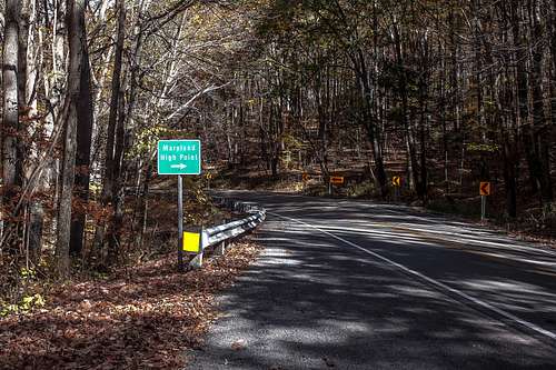
Sign on US 219 (silversummit, SummitPost, 2015)
Source: http://www.summitpost.org/trailhead-is-on-the-right/957276/c-152048


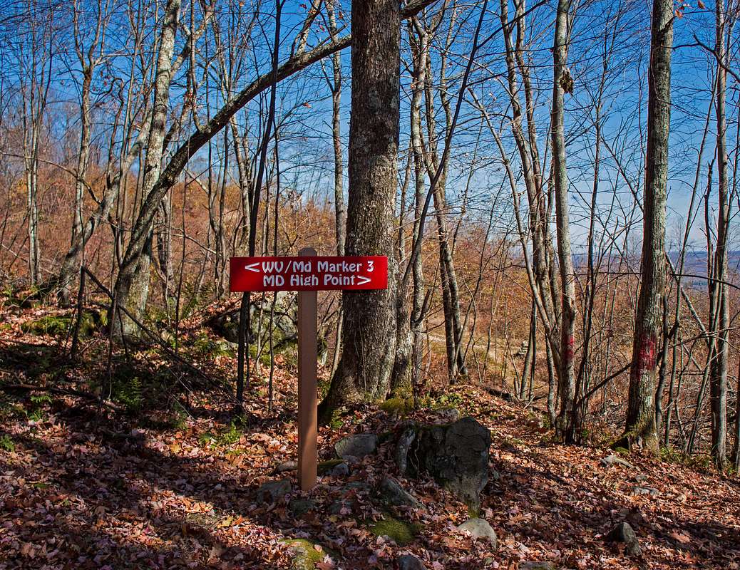
From the parking spot on the SB shoulder of US 219, there's a short road walk to the trailhead, which is located on the east side of the road opposite the "Maryland High Point" sign. There's a short walk along an old woods road (you could park up here if you have a car with 4WD), then the well-worn high point trail breaks off to the left. In West Virginia, the trail is marked with "blazes" consisting of "HP" spray-painted on trees. Not fancy, but effective. It's a steady climb up the ridge and a sharp turn to the south of over 90 degrees marks the halfway point. We continue climbing, roughly parallel to and just west of the state line. A hairpin turn to the left is near the top of the ridgeline and the trail begins to level off. Up here, we start to get some directional signage, and once the state line is finally crossed, painted HPs are replaced by cairns. There is a side trail to a boundary marker (more on that later).


Sign at boundary marker trail (silversummit, SummitPost, 2015)
Source: http://www.summitpost.org/high-point-sign-near-the-summit/957264/c-152048

The trail ascends slightly through a grassy area until you reach the true summit. Really hard to miss it, as there's a bench, MD State Highway Administration historic marker, mailbox with register, and cairn marking the true summit.


Look at that view! Maryland is more than coastal plains.
(My photo)
Summit area from bench. That mailbox has the register.
(My photo)


View of high point area (silversummit, SummitPost, 2015)
Source: http://www.summitpost.org/hp-hoye-crest-3360-ft/957254/c-152048
Closeup of historic marker (coloradoguy.com)
Source: http://coloradoguy.com/maryland-highest-point/backbone-mountain.htm


There's a mailbox up here that contains a register to let the world know you made it.


I made it! First visitor of the day (it was 9:30 AM).
(My photo)
Take a rest on the bench installed by the Highpointers Club, take some pics, read the historic marker, enjoy the beautiful view. When you're ready to head down, return south the way you came. If you're up for some minor rock scrambling, follow the signs over to Boundary Marker #3.


Boundary Marker #3 (My photo)
The current boundary markers in this area were installed in 1910 after a border dispute between Maryland and West Virginia. Continue past the marker to return to the main trail. The junction with the main trail does have a sign pointing to US 219.

Just as it was a steady climb up, it's a steady descent. On my way down, I passed a family making their ascent about midway between the two sharp turns. I reassured them that their vertical climb was almost done and the view was worth it. Once back to my car, it was on to Spruce Knob (and later Mount Davis).

Total ascent is approximately 700 feet. Round trip distance is 2.35 miles. Summit elevation: 3360 feet.


Getting There

As mentioned previously, the easiest way to the summit involves a hike through West Virginia. Trailhead is on the east side US Route 219, approximately 2.5 miles southwest of the Maryland/West Virginia state line and roughly 50 minutes from Interstate 68. I strongly recommend approaching from the north (or at least making a U-turn north of here if coming from the south), as the only real parking is on the wide SB shoulder. Closest food and gas is found in Oakland, MD, approximately 15 minutes north along US 219. The trail as shown on Google Maps is accurate, so you can use that for navigation.

Nearby State High Points

It is very common to combine a trip to Hoye-Crest with visits to the high points of Pennsylvania and Maryland, as you can easily hit all three of them in a day, which I did. Both Mount Davis (PA's high point) and Spruce Knob (WV's high point) can be driven, with relatively-flat walks of less than 5 minutes from car to summit. Both PA and WV have summit observation towers, though the view from PA is relatively bland. The area between Hoye-Crest and Spruce Knob is relatively remote, with few services. As this area is within the National Radio Quiet Zone, there is generally NO cell phone service south of Hoye-Crest.


Resources

Saturday, January 20, 2018

Snowshoeing at Anchor Diamond Park at Hawkwood

For the first time this year, we had a weekend day with snow on the ground where I was in town and it wasn't insanely cold. That can only mean one thing: snowshoeing. A friend of mine recommended Anchor Diamond Park in Ballston, NY, so off I went. Anchor Diamond is a relatively new park south of Ballston Spa, with ample parking on Middleline Road (Saratoga County 59) just north of NY Route 50 (map below)


Anchor Diamond was formerly the Hawkwood property, with the first building constructed in 1790 by Henry Walton. The property changed hands a few times until it was acquired by the Town of Ballston in 2014. The park finally opened in October 2016 with 2 trails. Trails have been added since then, with the solid trails in the map below currently "open". A loop around the perimeter trails (using the blue/yellow dashed connector) is approximately 2.6 miles.


Current map of the property. Dashed trail near top left is not blazed,
but it is marked with tape (and obviously used).

I arrived around 1 PM, strapped on the snowshoes, and began my walk through nature. The lot is plowed and sanded and a port-a-potty is present.

The sign and parking lot
The trailhead is at the southwest corner of the parking lot, near two benches. I started Samsung Health and began my hike on the main (white) trail, immediately turning right on the red trail. The trails here generally look like the photos below: flat and wooded.


I turned right onto the blue trail, continuing my trek west and deeper into the park.
Typical blazes at Anchor Diamond
The blue trail generally follows the north edge of the park, occasionally crossing an old stone wall. Most of the tracks turned onto the unopened dashed trail and I followed, cutting over to the yellow trail. While not blazed, the blue-yellow connector is marked with orange tape. There is an unbridged stream that may be difficult if there is no snow on the ground.

The yellow trail contains one of the highlights of the park: an old chimney, located at the back of the park.


I continued south on the yellow trail until it abruptly turned east at the southwest corner of the park.
END OF TRAIL. Knowing how many people in this area are armed,
I wouldn't pass that sign.
The yellow trail is a loop, so make sure you remember which end of the loop leads back to parking.


Yes, both ways are yellow. And I was on yellow when I took this.
Facing west toward the loop split.
Yellow eventually meets the main white trail (it continues west/right, but dead-ends almost immediately) and I turned left, soon turning right onto the orange trail along the SE side of the park.


White/Orange junction, looking west.
Looking east, you only have an orange blaze.

The orange trail does have one small unbridged stream.

Don't worry, you can step across it
The orange trail is often right against the property line, with a fence and field very close to the south side. It meanders its way along the south property line, eventually returning to the white trail a short distance from the parking lot.

If you want a pleasant hike in a beautiful area close to civilization, Anchor Diamond is the place for you. The dense trail network makes it very easy to choose your adventure, with both short and medium-distance hikes possible. And if weather turns bad, returning to the car is quick.

Intro

Greetings! I'm Josh. I'm a PhD student at RPI. Growing up near Lake George, I always had a love for the outdoors and, now that I have moved back to the area for grad school, I've re-immersed myself in the Capital District environment. I might spend most of my time in the office working on research, but if I'm not in there, chances are I'm on the trail or traveling somewhere.


Me on Mount Marcy, August 2017
Quite a few hiking challenges I'm working on at this time. I have visited 14 state high points plus the highest point in DC. I've been to the highest point in 27 of New York's 62 counties (and most of those are quite nice, although relatively undocumented hikes). I have 8 of the Lake George 12sters, 4 Adirondack High Peaks, 4 Catskill high peaks, and 7 of the 30 Adirondack and Catskill fire tower peaks. I plan to do writeups for all of these in the future, as several are wonderful hikes, but guides are either nonexistent or outdated for many.


Rensselaerville Falls, Huyck Preserve, Rensselaerville, NY

I travel quite often and I figured that I'd document my outdoor travels here. I do a wide range of hikes, both short and long, over a variety of landscapes. Outside Adirondack and Catskill Parks, trail guides are rare, so I'm feeling my way through with a map and GPS in many cases. Part of my goal with this site is to provide a comprehensive guide for hikes I take, with a special focus on Eastern New York, Southwestern Vermont, and Western Massachusetts. When I travel elsewhere and take a hike, those will be documented as well. Welcome to the adventure!