 |
| Benchmark at the true summit of Five Mile Mountain (All images mine) |
I wanted to get a challenge patch for my home region, so on a Sunday morning in early May, I decided to grab the last three peaks I needed and become a Lake George 12ster. Brown, Huckleberry, and Five Mile Mountains are the northern three main peaks on the Tongue Range and Five Mile also happens to be the one 12ster peak that actually requires a bushwhack to the summit (Erebus can be claimed without reaching the summit). These peaks aren't nearly as interesting as the southern three on the range, but it's a moderate out-and-back hike from the Deer Leap trailhead at the north end of the Tongue Mountain Range trail. If desired, all six Tongue Range peaks could be done as a traverse by spotting a car at one of the two trailheads or having an additional driver. The out-and-back from Deer Leap to Five Mile Mountain is approximately 7.3 miles with roughly 1,250 feet of total ascent.
I started up the trail around 9:30 AM on a Sunday morning in May. Later than I wanted to head out, but the parking lot was surprisingly empty. The lot is a gravel lot on the side of NY Route 9N that can hold approximately 10 vehicles. The trailhead is across the road from the parking.
 |
| Looking across to the trailhead |
From the road, the trail ascends gradually along an old logging road, then curves sharply to the left.
 |
| Don't go straight here |
At this point, we reach the register.
 |
| Closeup for regional emergency numbers |
The next 0.6 mile to the trail junction is a relatively standard walk through the woods, ascending gently. Leaves had just appeared on the trees and it was finally spring in the Adirondacks. Trails on the Tongue Range are sparsely blazed, but much of this trail is easy to follow. The main range trail is blue blazed.
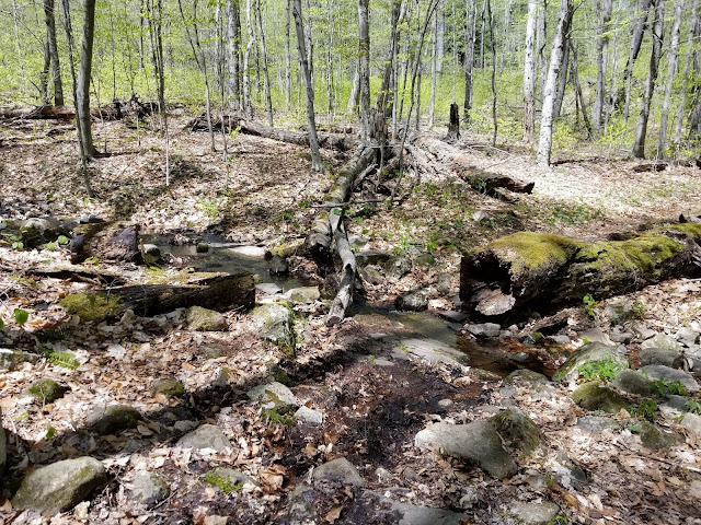
Along this initial stretch of trail, there are a couple of seasonal streams that were running well and a few muddy spots. This is some of the only water on the Tongue Range other than the lake itself.
Approximately 0.7 miles from the trailhead is the junction with the Deer Leep trail. Straight ahead takes you to Deer Leap in 1 mile. While not the best views on the range, Deer Leap is a relatively popular hike due to its short length and low difficulty. I turned right to continue south along the Tongue Mountain Range trail.
From here, the trail proceeds to the southwest, continuing to climb through the forest.
 |
| A tree fell across the trail, but the trail was cut through |
The trees and other plants in this area have grown into some interesting formations.
I saw a butterfly flutter past me while hiking through here. I had to stop and take a picture.
 |
| Zoomed-in view |
As the trail nears my first summit of the day, it narrows and has a couple of sections that are alongside a steep slope.
Markers in this area are infrequent, but the trail is not particularly hard to follow.
There were some trees lying across the trail. Given how little attention is paid to the Tongue Range trails, it wouldn't shock me if these stick around until someone decides to come up with an ax or saw and clear it themselves.
 |
| A few trees are across the trail up here |
Soon enough, about 1.7 miles from the trailhead, I was at the summit of Brown Mountain. Well, next to it, as there is a short bushwhack on the right/northeast side of the trail required to reach the actual high ground.
 |
| Sign at Brown Mountain summit, facing the trail. High ground is behind the sign. |
The summit area is relatively open and grassy with thin trees and the "bushwhack" to the high ground is little more than a walk through the grass.
 |
| Apparent high ground at summit |
The view from the true summit is obstructed by trees. I vowed to visit the overlook at the edge of the cliff on the return trip and pushed on after a quick break.
 |
| View toward Lake George from Brown Mountain summit |
From Brown Mountain, the trail continues to the southwest. Brown Mountain has a mere 60 feet of topographic prominence and its higher parent is Huckleberry Mountain, so the descent southwest from Brown is gradual and minimal.
Around the col between Brown and Huckleberry, there's a seasonal "stream" (more like muddy area) that the trail crosses. I wouldn't drink this water, as it was pretty stagnant.
From here, the trail begins to ascend again. There are some bare sections of rock between Brown and Huckleberry.
Some cairns in this area mark the trail.
 |
| Cairns are rarely needed to mark trails in the Southern Adirondacks |
From here to the Tongue Mountain lean-to, the trail has many open sections and can be hard to follow. Make sure you are following trail markers and, if in doubt, refer to a GPS or Google Maps, which does have trails on the Tongue Range.
The Tongue Mountain lean-to is in the middle of an area of bare rock, 2.6 miles from the trailhead and about 0.4 mile before the summit of Huckleberry Mountain. Behind the lean-to is a privy, one of few in this area and possibly the only one on the Tongue Range. A fire pit lies in front of the lean-to, but there aren't any views from here.
Continue to follow the trail, which remains relatively level, and, 3 miles from the trailhead, you'll reach Huckleberry Mountain. The sign is along the trail...
but the summit is just off of the trail, a large mound of exposed rock. Some minor scrambling is required to get up this thing.
 |
| Looking down the small scramble to the summit |
 |
| The apparent high ground |
 |
| View from the summit |
Huckleberry Mountain has a prominence of 120 feet above its col with Five Mile Mountain and the trail between the two descends that amount relatively quickly and steeply. This is easily the steepest section of marked trail on the range north of Five Mile's true summit, with a hairpin turn in there to allow for faster elevation change.
Ascending from the col, the trail makes a sharp 90 degree turn to the left, descends slightly, and makes a 90 degree turn to the right.
In this area, you need to pay attention if you want to find the herd path to Five Mile's true summit. The trail runs along the bottom of the shallow col separating Five Mile Mountain from a sub-peak to the east. Roughly 3.6 miles from the trailhead, there is a small cairn along the right (west) side of the trail. At this point, a herd path climbs up the slope to the summit. If you didn't know about the cairn, there's a good chance you'd miss the herd path.
 |
| That little cairn is where the herd path breaks off to the right. VERY easy to miss it, like I did on my way up. |
Of course, I missed the cairn and, seeing on my GPS that the peak was 90 degrees to my right, I bushwhacked up to the summit, joining the herd path near the top. Supposedly, there is a viewpoint with a sign saying "FIVE MILE MOUNTAIN" to the south of the true summit along the trail. If you reach this sign, you have gone too far.
 |
| The ground along my bushwhack |
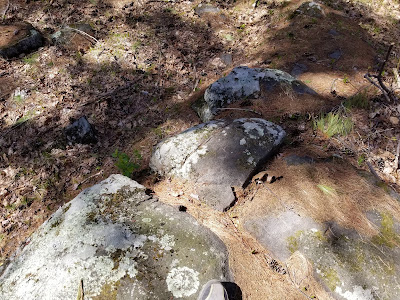
The herd path fades away at two rock outcroppings. The one on the left was taller, so I went up and searched for the benchmark. After some time searching around the tallest rock outcropping, I found the benchmark, hiding under a tree.
Five Mile Mountain, at an elevation of 2,256 feet, is the highest point on the Tongue Range and my 12th and final 12ster. The view isn't as spectacular as some of the other challenge peaks, but it was quite satisfying and I had the summit to myself.
 |
| View to the east from true summit |
 |
| Picture to prove I made the bushwhack |
The patch was mine...once I got down the mountain and back home to submit the form. This time, I decided I'd follow the herd path to see where it came out on the main trail. It was relatively steep and my poles were quite useful on the descent.
 |
| Looking down the herd path |
Back on the main trail, I spotted the cairn marking the location of the herd path and began my hike back to the car. Other than the steep-ish hike up Huckleberry and the gradual ascent up Brown, the trail was mostly downhill with some level sections, making the return trip relatively quick.
 |
| The steep ascent up Huckleberry |
 |
| Passing Huckleberry |
Virtually all of the trail markers I saw on this hike were dated 1967. Given the lack of trail markers, I wouldn't be shocked if that was the last time this trail got a new set of blazes. It's definitely overdue for more.
I got slightly off trail in the open area just north of the lean-to. Noticing something seemed different than my hike up, I used my GPS track to cross over the open area and return to the trail. Definitely make sure you're looking closely for blazes in this area and retrace your steps if something seems off.
 |
| It's kind of easy to lose the trail up here |
The remainder of the trail down is remarkably easy to follow
 |
| The col between |
As I promised myself, I stopped at the overlook at Brown Mountain, which provided the best views of the hike
I even saw some flowers at the overlook.
Behind me was the true summit of Brown, which I felt no need to reascend.
The descent from Brown to the trailhead was steady and uneventful. With how easy it was, I had to prevent myself from running (and potentially tripping). Left at the junction leads back to the trailhead.
 |
| Approaching the Deer Leap junction |
 |
| The small seasonal stream crossing on the lower part of the trail |
Before I knew it, I was back at the trail register.
After 7.3 miles of hiking that day, I had finally climbed the final 3 peaks required to become a 12ster. I was ready to get back in my car and head home to send in my form.
The northern half of the Tongue Range isn't nearly as interesting as the southern half, but it's much easier and can be done in the span of a few hours. Regardless, if you want to complete the 12ster, you'll need to hike this thing and it's certainly an enjoyable hike to complete.
 |
| My reward showed up the following Friday |
Getting Here
The Deer Leap trailhead is located on NY Route 9N a short distance south of Silver Bay, 9.5 miles north of Warren County Route 11 and roughly 14 miles from I-87 at Exit 24. If you are coming from the south and reach Sabbath Day Point or Silver Bay, you have gone too far.
Resources
- Eastern Region Backcountry Information (NYSDEC): General trail conditions and other information for the region
- The Adirondack Mountain Club's Eastern Trails guide, edited by David Thomas-Train
- National Geographic Trails Illustrated Map 743 (Lake George/Great Sacandaga)


