 |
| View from Giant Ledge |
Among peak challenges, the Catskill 3500 Club has a unique requirement: in order to join the ranks of patch-holding members, you need to climb four of the peaks twice. One of those times must lie in the winter season, or between December 21 and March 21 (inclusive). These four peaks are Blackhead, Balsam Mountain, Slide Mountain, and the hike featured here, Panther Mountain. The first part of Winter 2018-19 was very light, so I figured this year was as good as any to get one of the required winter hikes out of the way.
Panther Mountain has a somewhat different origin from other peaks in the Catskills. Looking at a map of the area, it appears as though the mountain is the site of an ancient meteorite impact crater. This belief is supported by geologists' findings. Panther Mountain is a 6.8-mile round-trip from the parking area, Giant Ledge is half of that.
January 2 is normally quite snowy in the Catskills, but 2019 was different. Close to no snow below 3,500 feet and only an inch or two above there.
 |
| Trailhead from parking area |

Wearing far too many layers (as I would discover shortly), up the yellow-blazed Phoenicia-East Branch Trail I went.
 |
| The beginning of the trail |
 |
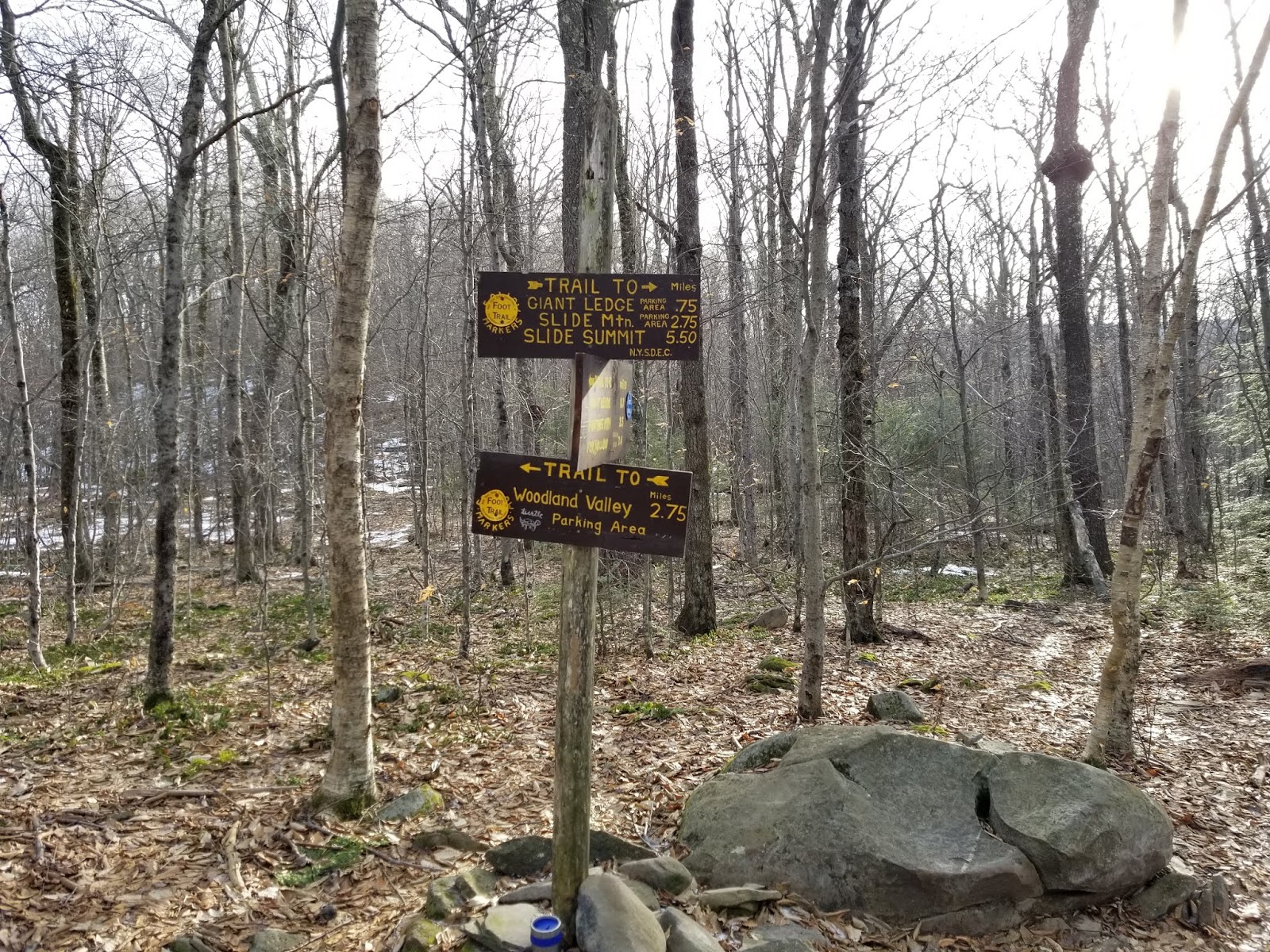
| Distance sign at trailhead |
 |
| Another distance sign |
 |
| Looking toward trail register |
A short distance from the trailhead are an information kiosk and trail register.


 |
| Trail register |
Signed in, I was ready to go.

Almost immediately, the trail crosses a tributary of the Esopus Creek on a relatively-new wooden bridge.

 |
| Looking upstream at rapids |
Across the stream, the real climbing begins. In the next 2/3 mile to the trail junction, we climb 500 feet.


0.7 mile from the trailhead, we're at the col separating Slide and Panther Mountains and the junction with the blue-blazed Panther Mountain Trail.


From here to Giant Ledge, it's generally a gentle ascent with a couple of steep sections near the Giant Ledge overlook.


You know you're close to Giant Ledge when the trail gets noticeably steeper


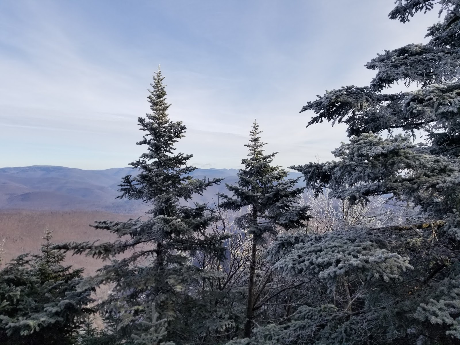
Roughly 1.7 miles from the trailhead, we have reached Giant Ledge there are a handful of overlooks on the right side of the trail.
 |
| View from Giant Ledge |

If you so desire, there are designated primitive campsites on the summit of Giant Ledge


If you're only here for the view and not trying to claim a Catskill High Peak, I'd suggest stopping at Giant Ledge. Why? The view at Giant Ledge is quite a bit better than Panther Mountain. Me? I wanted the high peak, so I pressed on.

After the summit of Giant Ledge, the microspikes went on as the trail started to get quite icy.


 |
| Once last view from Giant Ledge before going to Panther |


There's a descent of maybe 200 feet into the col between Giant Ledge and Panther, and on the day I hiked it, the descent was a giant sheet of ice.


Past the col, the moderate climb resumes.
 |
| I'm a sucker for ruck formations |

 |
| Nature reclaimed this trail marker |


Soon enough, we're at 3,500 feet.

The trail continues to climb up to the summit elevation of 3,720 feet.


The trail levels off as it gets close to the summit.
 |
| Near the summit |

You know you're at the summit because a) the trail stops climbing and b) there is a view to the right.
 |
| View from Panther Mountain summit |
 |
| It's a long, steep, icy way down |
 |
| Looking south along trail |
 |
| Looking north along trail |
The trees up here were coated in a thin layer of ice, which made for an interesting aesthetic.

There wasn't much of a place to sit and the wind was quite cold, so I didn't spend much time at the summit. The trip down was pretty uneventful, passing several other hikers along the way.


 |
| Descending from Panther summit |
My Hillsounds trail crampons were very useful here, as the trail descending Panther was mostly covered in ice.


From the Panther-Giant Ledge col, there is supposedly a bushwhack route down to the trailhead, but I wasn't feeling that adventurous, so back over Giant Ledge I went
 |
| Trail at the col |
 |
| Ice on the climb back up to Giant Ledge |
Passing over Giant Ledge, enjoy the view one last time before returning to the trailhead.


As mentioned earlier, there is a marked campsite near the summit of Giant Ledge.


 |
| A spring is located along the trail just south of the summit |


Back at the trail junction, right leads to the trailhead.
 |
| Looking northeast toward Woodland Valley from junction |
The descent from the trail junction to the parking lot is probably the longest steep descent of the trail.


 |
| Back at the stream |
 |
| Looking downstream |

Soon enough, I'm back at the trailhead, ready to head home and rest for my next adventure.

A moderate but enjoyable hike, Panther Mountain is a great way to spend a few hours and enjoy the outdoors.
Getting Here
Panther Mountain is located in central Ulster County. The main trailhead (signed as the Giant Ledge trailhead) is located at a hairpin along Ulster County Route 47, which is signed as Oliverea Road, Oliverea - Slide Mountain Road, or Frost Valley Road, roughly 45 minutes from Kingston.
References/External Links
The Adirondack Mountain Club's Catskill Trails (4th Edition) (Carol White and David White, ed.)
Giant Ledge and Panther Mountain at Hike the Hudson Valley: An excellent resource showing pictures of the mountain in late fall