 |
| Looking toward the Mohawk River |
Hidden away in the Town of Colonie is the Fox Preserve, a 70-acre property only a short distance from the Latham shopping district. Acquired by the Mohawk-Hudson Land Conservancy in 2015, its 1.25 miles of well-maintained trails opened to the public in October 2017.
While not a place for a long excursion, the Fox Preserve's easily-accessible location makes it a good destination for a short walk if you want to stay close to home or hike as part of a shopping trip. Indeed, wanting to enjoy the warmer-than-normal weather in early February 2019 is what brought me to the Fox Preserve on a Sunday afternoon.
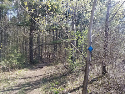
There is one main trail, blazed in orange, that makes a 0.9-mile loop. An alternate white-blazed trail adds a small distance to the loop. During my visit, I stuck to the clearly-blazed orange trail.
Starting at the kiosk, I headed west (counterclockwise) along the orange trail. We pass through a stand of trees and climb a gentle hill to a clearing.
A picnic table provides a place to rest and enjoy the scenery at the clearing.
Looking north, we have the only real scenic vista at the preserve: a view of the wetlands along the Mohawk River.
According to the trail map, the white trail breaks off at this clearing, but it is not clearly marked. Continuing along the orange trail, the we proceed east through a level stand of forest.
Soon enough, things become more interesting as we approach the Shaker Creek ravine. At first, there is a drop-off to the left...
then the trail begins to drop into the ravine.
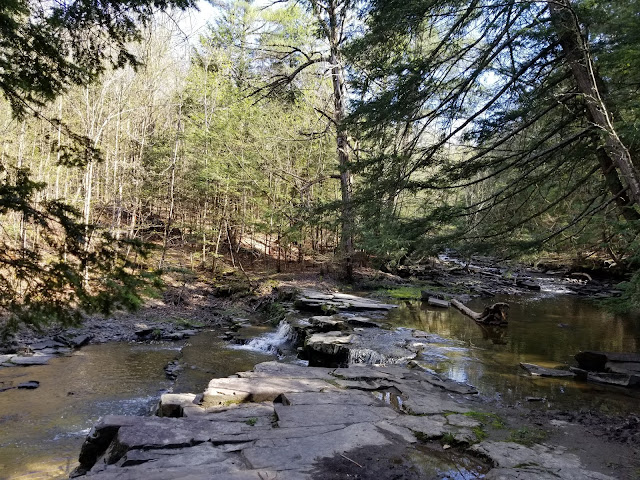
At the east end of the preserve, the trail makes a wide U-turn to the left, turning to follow the path of Shaker Creek.
There's a man-made waterfall across the ravine from this turn, in the form of a drainage pipe emptying into Shaker Creek.
Now heading west, the trail passes through slightly more rugged terrain along the creek.
Nearing the parking lot, the trail pulls away from the creek and passes through a stand of trees
Soon enough, we're back at the parking lot, facing the trailhead kiosk.
While it isn't a place to visit if you hope to hike all day (I made the loop in roughly 25 minutes), the Fox Preserve is a nice little suburban oasis that is now open for the public to enjoy.
 |
| Trail map, posted at trailhead kiosk |
While not a place for a long excursion, the Fox Preserve's easily-accessible location makes it a good destination for a short walk if you want to stay close to home or hike as part of a shopping trip. Indeed, wanting to enjoy the warmer-than-normal weather in early February 2019 is what brought me to the Fox Preserve on a Sunday afternoon.
 |
| Trailhead kiosk |
There is one main trail, blazed in orange, that makes a 0.9-mile loop. An alternate white-blazed trail adds a small distance to the loop. During my visit, I stuck to the clearly-blazed orange trail.
Starting at the kiosk, I headed west (counterclockwise) along the orange trail. We pass through a stand of trees and climb a gentle hill to a clearing.
 |
| Approaching the clearing |
A picnic table provides a place to rest and enjoy the scenery at the clearing.
 |
| Clearing and picnic table |
Looking north, we have the only real scenic vista at the preserve: a view of the wetlands along the Mohawk River.
 |
| View at clearing |
According to the trail map, the white trail breaks off at this clearing, but it is not clearly marked. Continuing along the orange trail, the we proceed east through a level stand of forest.
Soon enough, things become more interesting as we approach the Shaker Creek ravine. At first, there is a drop-off to the left...
then the trail begins to drop into the ravine.
At the east end of the preserve, the trail makes a wide U-turn to the left, turning to follow the path of Shaker Creek.
 |
| Shaker Creek |
There's a man-made waterfall across the ravine from this turn, in the form of a drainage pipe emptying into Shaker Creek.
 |
| Drainage outlet |
Now heading west, the trail passes through slightly more rugged terrain along the creek.
Nearing the parking lot, the trail pulls away from the creek and passes through a stand of trees
Soon enough, we're back at the parking lot, facing the trailhead kiosk.
While it isn't a place to visit if you hope to hike all day (I made the loop in roughly 25 minutes), the Fox Preserve is a nice little suburban oasis that is now open for the public to enjoy.
Getting Here
The Fox Preserve is located on River Road in the northern part of the Town of Colonie. A paved parking lot on the south side of the road serves as the trailhead.
External Links
Mohawk Hudson Land Conservancy - Fox Preserve: Official website


