 |
| If you want to see to the horizon, this is your place |
After hiking Tremper Mountain in early May, I had visited 3 of the 5 Catskill fire towers. Having seen that Balsam Lake Mountain and Red Hill are both relatively easy hikes, I figured I'd get the remaining two fire towers on one trip, separated by a 70 minute drive.
 |
Sign at the trailhead
|
I'll give the warning now: this area has a high bear population and I did see a large bear along the trail while returning to my car. Make noise and they'll leave you alone.
I arrived at the kiosk around 9 AM on a quiet Tuesday morning in May. A kiosk points you in the right direction. Do note that the trail to the fire tower begins across the road.
 |
| The beginning of the trail from the parking lot |
Across the road, there's a sign giving distances and a ton of POSTED signs. Much of the trail passes through private property and, as such, camping is generally not permitted.
The trail ascends gently through the quiet forest.
1/4 mile from the road, the trail register appears on the left.
Signed in, I continued on my way.
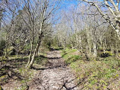
Much of the trail is like this. Nothing that particularly stands out, but quite pleasant and enjoyable hiking.
A little under a mile in, there's a hairpin to the left and the trail becomes a little steeper.
A short while later, there's a sharp curve to the right.
A spring along the left side of the trail provides a chance to get water. Reminder: if collecting spring water or water from any other unfiltered source, it needs to be purified.
 |
| Spring |
Some signs of spring were hiding along the side of the trail.
About 2 miles from the trailhead, the trail makes a slight turn to the right and a path comes in on the left. This unmarked path to the left is the most common way to bushwhack up Graham Mountain, another Catskill High Peak. As my goal today was fire towers, I left Graham for another time.
 |
| Path for bushwhack to Graham Mountain |
Up ahead, there's a junction. Slight right (following the red markers) is the most direct way to the fire tower, so that's how I went.
 |
| The fork. Left here is the direct trail to the summit. |
Immediately, we run into a gate. Walk around the gate and the final 3/4 mile begins.
This final section of trail is noticeably steeper, but still easy to moderate by Catskills standards.
As we continue to gain elevation, the trees start to become evergreen and we cross onto state land.
Soon after entering state land, we're crossing the 3,500 foot contour.
Near the summit, the trail levels off and passes through a muddy area.
 |
| In the background of this image is a long stretch of mud |
Finally, we're there. Coming on a weekday in the spring, I had the place to myself, even if the tower cab was locked.
Standing at the edge of the summit clearing is the Balsam Lake Mountain fire tower. Since the summit is covered in trees, your only chance at a view is to start climbing.
 |
| Guess I'm going up |
Balsam Lake Mountain is the southwesternmost of the Catskill High Peaks and it shows. The view to the south and west seems endless, while looking northeast allows you to view the other high peaks.
Disregarding the picnic table in the clearing, I ate an early lunch up on the steps with the world beneath me.
 |
| Picnic table in clearing |
Alas, since I wanted to make it up Red Hill on the same trip, I had to make my way down and back to the car.
 |
| One last look to the horizon |
Back on terra firma, I began my descent.
 |
| Privy in the woods alongside the clearing |
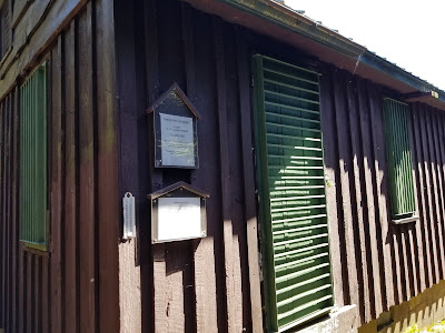
Before departing, I checked out the boarded-up observers cabin.
 |
| Nice, comfortable spring weather |
Now it was time to go down. Remember the mud I mentioned on the ascent? Here's a view of that from the clearing side.
Past the mud, the long, gradual descent began.
The lack of leaves up here meant that I could get a glimpse of nearby Graham Mountain from the trail.
Back at the trail junction, slight left puts us on the old fire road...
with an almost immediate slight left to stay on the main trail (and avoid heading toward Graham Mountain)
 |
| Left to trailhead, right to Graham Mountain |
It was around here when I saw a large black bear a few hundred feet ahead of me on the trail. Sadly, I did not think to take a picture until after I scared it away to clear a path down. I made quite a bit of noise during the remainder of my time here to try and prevent further wildlife encounters.
Soon enough, I was back at the road.
Balsam Lake Mountain may be remote, but it's a fun hike that rarely gets harder than "walk in the woods" difficulty and the feeling of being able to see to the horizon. If you're lucky, you might even be able to see some of the Catskills' best-known animal residents.
But wait, there's more! If you've already traveled this far, why not travel a little further west down the road to the Millbrook Covered Bridge? Constructed in 1902, the bridge stopped serving vehicles in 1964, but remains in excellent shape and worth a quick stop.
Getting Here
Balsam Lake Mountain is located in the Town of Hardenburgh, a remote community in extreme western Ulster County. The trailhead described here is located on Mill Brook Road and approaches the mountain from the north.
References
The Adirondack Mountain Club's Catskill Trails, 4th Edition (Carol and David White, eds.) was the trail guide I used for this hike


