Showing posts with label Berkshire County. Show all posts

Thursday, May 3, 2018

Pine Cobble: Southern Tip of the Green Mountains

View toward North Adams from Pine Cobble

A friend of mine recommended a hike up the Pine Cobble in Williamstown, Massachusetts and, after reading reviews, I had trouble passing it up. It's not a particularly long hike, but I figured it would be a great early-season warm-up for longer hikes I had planned in similar terrain. Combined with a hike on the Old Mohawk Trail (not recommended unless you're really into old roads), it made for a nice late April day.

Pine Cobble Mountain is generally considered the southernmost summit of the Green Mountains, separated from the Taconic Mountains and Berkshire Hills by the Hoosic River's two branches. While not particularly high, the summit (elevation 1,893 feet) is far above upper the Hoosic Valley and provides panoramic views of North Adams and Williamstown. An out-and-back hike along the main trail is 3.6 miles per GPS, 1.8 miles each way, with roughly 1,250 feet of total ascent. The mountain is close to Williams College and, as such, many hikers while classes are in session are students. The parking lot is small, so I'd recommend hiking at off-peak times. The trail has no restroom facilities.

I started up Pine Cobble shortly after 1 PM on a partly cloudy Saturday afternoon. Rain was forecast for late afternoon, so I was hoping to get back to my car before the rain began. There is a small parking lot that can hold 6-7 cars if parked tightly. Don't park on the road.

Follow the signs. Please.

The parking lot

Walk a short distance uphill along the road to reach the well-marked trailhead.


The first bit of trail is relatively flat.

The sign lies. 1.6 miles is to the turnoff for the summit.

As an official spur of the Appalachian Trail, the Pine Cobble Trail has blue blazes.

Lower part of the trail looks like this 


At least the fourth sign showing the trail's name in the first 1/4 mile

After an initial gradual ascent, the trail descends into a ravine to cross a small stream. Once we're across, our climb can begin.

Descending into the ravine

Climbing back up 

Near the 1/2 mile mark, we reach a steep section with several switchbacks. Stairs make the climb a little easier.

Some of the stairs


Yup, those are more stairs

Once the hairpins are passed, the trail levels off again. There is a well-signed turn to the right.


At roughly the 1 mile mark, the Class of '98 Trail departs to the left. This trail connects to the Appalachian Trail and can be used as part of a loop in conjunction with the Pine Cobble Trail


Sign at '98 Trail junction. This distance is correct.
I was thinking it was a really easy hike until I hit this junction. Then the real climbing began. I looked at my phone and realized I still had over 700 vertical feet to climb.


Here we go...

After the initial climb from the '98 junction, we reach another welcome sign, roughly 1.1 miles from the trailhead. At this sign, the trail sharply turns right onto an obvious reroute.


By this point, at least 1.25 miles into the hike, I was surprised at the lack of rocky sections. Well...


You wanted rocks? Here's a steep rocky section!
The next ~0.4 miles alternates between a gradual ascent and a steep, rocky climb.

Just some good ol' New England Hiking

Someone made a cairn


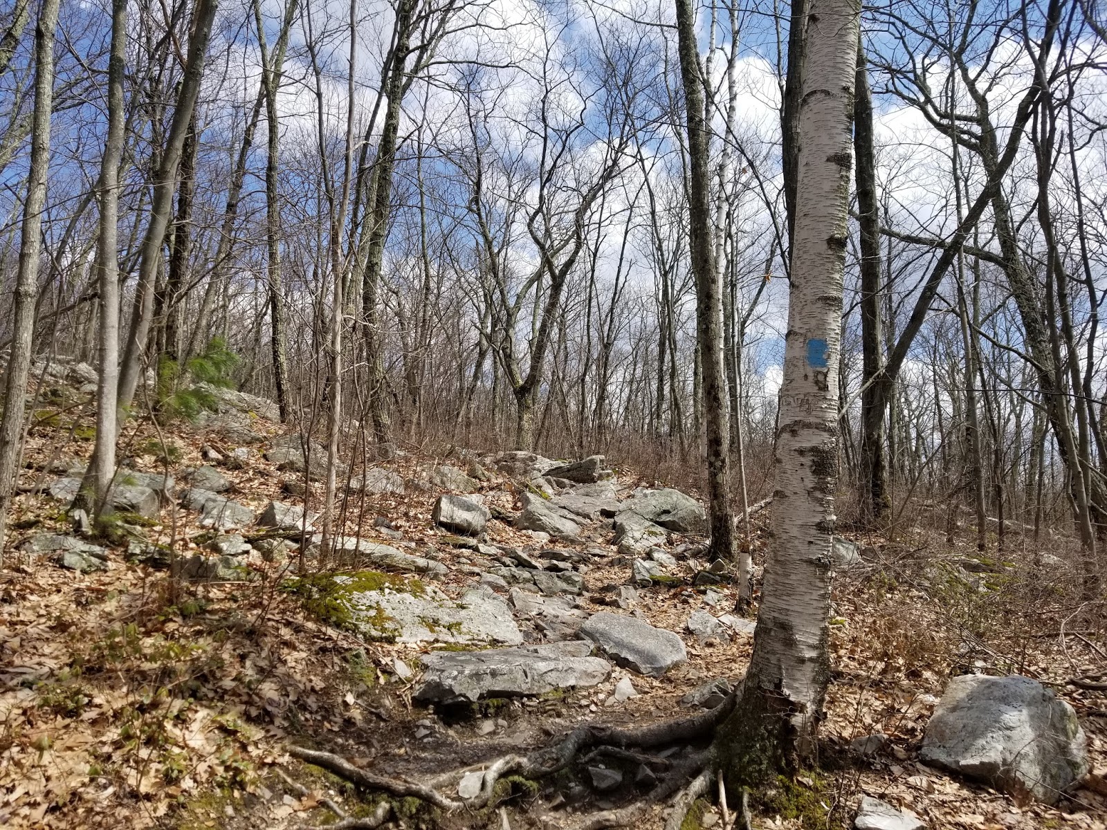
Typical scene along the upper half of the trail


The last steep climb
After the longest steep section along the trail, it levels off and we immediately hit a junction. Left leads to the Appalachian Trail and the other end of the '98 Trail. We want to go RIGHT to Pine Cobble.

The junction

The final bit of the trail is relatively level as we hike along the top of the ridge.


Soon enough, we're at the summit. True summit is marked by a drill hole on the tallest rock outcrop.

The true summit

Beyond the summit is an overlook to the southeast and North Adams, while to the right is an overlook to the southwest and Williamstown. We'll start by looking southeast.

Looking southeast. North Adams is at the left.
The Hoosac Range is in the background, Greylock at the right.

Looking north toward the rest of the Green Mountains

The summit was somewhat busy with students from nearby Williams College, so there wasn't a ton of room to rest up here. That being said, if any of my universities were near hiking like this, I'd probably be spending all my free time enjoying the view as well.

Backtracking out to the other overlook...

Williamstown and the Taconic Mountains

The clouds were beginning to roll in fast, so I figured I should start down the mountain.

Down generally looks like this

It's a pretty easy descent, not too steep to take at a brisk walk.

Approaching the uppermost welcome sign

Junction with the '98 Trail. Left leads to the trailhead.

A few mud patches on the lower part of the trail

Flat section above the stairs

Going down the stairs

Forgot about this climb out of the ravine near the trailhead...

Roughly 2 hours after leaving, I was back at my car. Pine Cobble is great if you want a taste of New England hiking, as a practice for larger mountains, or in combination with attractions or other hikes in the area (still quite a few I need to do).

Getting Here


Pine Cobble is located in Williamstown, Massachusetts, roughly 2 miles from the center of Williamstown Village, 4.5 miles from North Adams, 14 miles from Old Bennington, Vermont, and 22 miles from Pittsfield. A full range of services is located in Williamstown and North Adams.

Friday, April 6, 2018

South of Frissell: Connecticut's Highest Point, plus the CT/MA/NY Tripoint

In county highpointing, there are several counties where the high point is not a summit, but somewhere along the county line on sloping terrain. We call these "liners". Only one state high point can make such a claim and that's Connecticut. Yes, Tennessee and South Carolina have their highest points along their borders, but these are actual summits. A dozen or so others have their high points within a few miles of another state. But Connecticut is the only one with a prominence of 0 feet. Not even a summit, the official high point is the South Slope of Mount Frissell. The summit of Mount Frissell lies 150 yards inside Massachusetts. Most of the hike to the high point lies inside Massachusetts. Bear Mountain, a couple miles to the east and 50 feet lower, is the highest summit inside Connecticut itself. Connecticut's true high point is the south slope of Mount Frissell, an elevation of 2,379 feet marked by a survey spike. It's not as fancy as other states, but the view isn't something to sneeze at, either.

There are three ways to hike here, and all are surprisingly difficult for a state like Connecticut. Easiest way is from the east, and that is what I'll write about here. You could also hike from the southwest over Brace Mountain or from the northwest near Alander Mountain, but each of those is a strenuous hike starting well under 1,000 feet. The eastern trailhead is just shy of 1,900 feet and, while you need to climb over Round Mountain and Frissell itself, it's a moderate hike.

The trailhead from the east is on East St in Mount Washington, Massachusetts. A small amount of parking is located near the state line, with room for a few cars on the east side of the road just north of a boundary marker.

CT/MA boundary marker along road

Having left slightly later than I intended, I set out at 10:45 AM From there, I hiked west along the blue blazed and aptly-named "Mt. Frissell Trail". This trail generally runs along the state line, first heading northwest and ascending ever so slightly. After roughly 1/5 mile, there's a sharp turn to the south. Just after entering Connecticut for the first time, it turns west and the trail became steeper as I climbed Round Mountain, with a couple minor scrambles for good measure. Maybe 3/4 of a mile into the hike, the trail levels off at the bald summit of Round Mountain. Round Mountain, elevation 2,296 feet, is the second-highest summit inside Connecticut.


Cairn marking Round Mountain's summit

View south from Round Mountain

After taking a 20-30 minute break on a rock for water and an early lunch (it was already quite warm at 11:15 AM) while enjoying the view of the mountain I was about to climb, onward and downward I went. Steep at times, the trail descends into the col separating Round and Frissell and we eventually start to climb Frissell. Near the summit of Frissell lies a very short spur trail to the true summit, marked by a sign, cairn, and register, along with directions from here to the CT high point. Sign your name, head back to the main trail, and continue on (and DOWN) the remaining 300 yards to the high point, which is located at the right (north) side of the trail, approximately 1.5 miles into the hike.

A little anticlimactic, isn't it?

Well, there we go. That little survey spike lies on the highest piece of land along the Connecticut/Massachusetts border. There's an ammo box here containing a register. While its main claim to fame is being the only state high point that isn't a summit, this place does have a nice view, even if it is only to the south. Much better view than the highest points of several states, actually.


Two looks south from Frissell

Once you're done at the high point, you have some options. Either you can return now, or you can continue downhill to the tripoint marker (and to Brace Mountain if you're so inclined). I continued on. After a short gentle downhill section, there are some steep scrambles. Roughly 1/4 mile west of Connecticut's highest point, we reach the tripoint lying on the trail.

The CT/MA/NY tripoint marker


MA occupies the entire north half of the marker (right side if coming from the east). NY is the southwest corner, CT is the southeast corner. For some reason, Connecticut's name is not etched on the marker.

From here, many people continue on to Brace Mountain, highest point in Dutchess County, New York. Since I wanted to get to Rhode Island's high point before it closed for the day, I hightailed it back to my car and did Brace a few months later from the spectacular western approach (future post).

Saw this sign across from the trailhead on my way out

While only 3.2 miles in length, this hike took me 2-2.5 hours, including breaks. Lots of rock scrambles to slow you down, plus I took plenty of time to enjoy the view and make sure I had water. A large amount of the difficulty here stems from the amount of rock scrambles and how exposed the trail is.

Getting Here

Connecticut might be a relatively-dense state, but its high point is in a pretty remote area. The trailhead is located on East St just north of the CT/MA state line at the southern edge of Mount Washington State Forest. No services are anywhere near the trailhead There are three main ways to get here:
  1. From MA Routes 23/41 to the north. This is the most direct access from points north and the Mass Pike/Interstate 90 and how I got to/from the trailhead. Roughly 2.5 miles is unpaved.
  2. From NY Routes 22/344 to the northwest. This route goes past Bash Bish Falls and merges with the above route near the trailhead. Doing this, you could easily add a stop at the falls. A minimum of 2.5 miles is unpaved (as above), more will be unpaved if you cut a corner and bypass Mount Washington Center. 
  3. From US Route 44 in Salisbury. A minimum-maintenance road heads northwest from Salisbury and is the only way to reach the area of the CT high point through CT itself by car (though you cannot get to the high point without entering another state). Most of this route is unpaved and it does not get a ton of use. About 6 miles is unpaved.

Resources

Mount Washington State Forest: On the MA side of the border in this area