Showing posts with label State High Points. Show all posts

Friday, April 6, 2018

South of Frissell: Connecticut's Highest Point, plus the CT/MA/NY Tripoint

In county highpointing, there are several counties where the high point is not a summit, but somewhere along the county line on sloping terrain. We call these "liners". Only one state high point can make such a claim and that's Connecticut. Yes, Tennessee and South Carolina have their highest points along their borders, but these are actual summits. A dozen or so others have their high points within a few miles of another state. But Connecticut is the only one with a prominence of 0 feet. Not even a summit, the official high point is the South Slope of Mount Frissell. The summit of Mount Frissell lies 150 yards inside Massachusetts. Most of the hike to the high point lies inside Massachusetts. Bear Mountain, a couple miles to the east and 50 feet lower, is the highest summit inside Connecticut itself. Connecticut's true high point is the south slope of Mount Frissell, an elevation of 2,379 feet marked by a survey spike. It's not as fancy as other states, but the view isn't something to sneeze at, either.

There are three ways to hike here, and all are surprisingly difficult for a state like Connecticut. Easiest way is from the east, and that is what I'll write about here. You could also hike from the southwest over Brace Mountain or from the northwest near Alander Mountain, but each of those is a strenuous hike starting well under 1,000 feet. The eastern trailhead is just shy of 1,900 feet and, while you need to climb over Round Mountain and Frissell itself, it's a moderate hike.

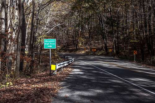
The trailhead from the east is on East St in Mount Washington, Massachusetts. A small amount of parking is located near the state line, with room for a few cars on the east side of the road just north of a boundary marker.

CT/MA boundary marker along road

Having left slightly later than I intended, I set out at 10:45 AM From there, I hiked west along the blue blazed and aptly-named "Mt. Frissell Trail". This trail generally runs along the state line, first heading northwest and ascending ever so slightly. After roughly 1/5 mile, there's a sharp turn to the south. Just after entering Connecticut for the first time, it turns west and the trail became steeper as I climbed Round Mountain, with a couple minor scrambles for good measure. Maybe 3/4 of a mile into the hike, the trail levels off at the bald summit of Round Mountain. Round Mountain, elevation 2,296 feet, is the second-highest summit inside Connecticut.


Cairn marking Round Mountain's summit

View south from Round Mountain

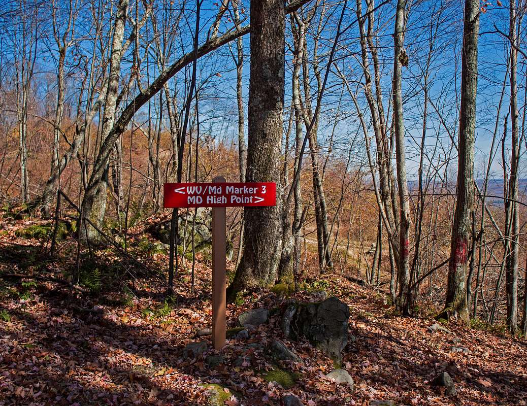
After taking a 20-30 minute break on a rock for water and an early lunch (it was already quite warm at 11:15 AM) while enjoying the view of the mountain I was about to climb, onward and downward I went. Steep at times, the trail descends into the col separating Round and Frissell and we eventually start to climb Frissell. Near the summit of Frissell lies a very short spur trail to the true summit, marked by a sign, cairn, and register, along with directions from here to the CT high point. Sign your name, head back to the main trail, and continue on (and DOWN) the remaining 300 yards to the high point, which is located at the right (north) side of the trail, approximately 1.5 miles into the hike.

A little anticlimactic, isn't it?

Well, there we go. That little survey spike lies on the highest piece of land along the Connecticut/Massachusetts border. There's an ammo box here containing a register. While its main claim to fame is being the only state high point that isn't a summit, this place does have a nice view, even if it is only to the south. Much better view than the highest points of several states, actually.


Two looks south from Frissell

Once you're done at the high point, you have some options. Either you can return now, or you can continue downhill to the tripoint marker (and to Brace Mountain if you're so inclined). I continued on. After a short gentle downhill section, there are some steep scrambles. Roughly 1/4 mile west of Connecticut's highest point, we reach the tripoint lying on the trail.

The CT/MA/NY tripoint marker


MA occupies the entire north half of the marker (right side if coming from the east). NY is the southwest corner, CT is the southeast corner. For some reason, Connecticut's name is not etched on the marker.

From here, many people continue on to Brace Mountain, highest point in Dutchess County, New York. Since I wanted to get to Rhode Island's high point before it closed for the day, I hightailed it back to my car and did Brace a few months later from the spectacular western approach (future post).

Saw this sign across from the trailhead on my way out

While only 3.2 miles in length, this hike took me 2-2.5 hours, including breaks. Lots of rock scrambles to slow you down, plus I took plenty of time to enjoy the view and make sure I had water. A large amount of the difficulty here stems from the amount of rock scrambles and how exposed the trail is.

Getting Here

Connecticut might be a relatively-dense state, but its high point is in a pretty remote area. The trailhead is located on East St just north of the CT/MA state line at the southern edge of Mount Washington State Forest. No services are anywhere near the trailhead There are three main ways to get here:
  1. From MA Routes 23/41 to the north. This is the most direct access from points north and the Mass Pike/Interstate 90 and how I got to/from the trailhead. Roughly 2.5 miles is unpaved.
  2. From NY Routes 22/344 to the northwest. This route goes past Bash Bish Falls and merges with the above route near the trailhead. Doing this, you could easily add a stop at the falls. A minimum of 2.5 miles is unpaved (as above), more will be unpaved if you cut a corner and bypass Mount Washington Center. 
  3. From US Route 44 in Salisbury. A minimum-maintenance road heads northwest from Salisbury and is the only way to reach the area of the CT high point through CT itself by car (though you cannot get to the high point without entering another state). Most of this route is unpaved and it does not get a ton of use. About 6 miles is unpaved.

Resources

Mount Washington State Forest: On the MA side of the border in this area

Thursday, April 5, 2018

Short Hike #3: Driskill Mountain, Highest Point in Louisiana

Summit kiosk (all pictures mine)

As a whole, Louisiana is pretty flat. And by "flat", I mean flat. But luckily for us, Northern Louisiana has some hills, including the state's highest point. Driskill Mountain, with a summit elevation of 535 feet, is hardly a mountain in the normal sense of the term and the third-lowest state high point, but it's hard to find higher ground in this part of the country. That being said, it's quite a pleasant hike and not particularly difficult. If you're traveling on nearby Interstate 20 (less than 15 miles away), Driskill is an interesting detour that will take less than 2 hours.

I started up Driskill around 8:30 AM on the morning of March 17th from the trailhead at Mount Zion Presbyterian Church, roughly 10 miles south of Arcadia. May have been early on a Saturday, but it was already humid and heating up.

Trailhead is at the back of the parking lot next to a service road

The trail is pretty easy to follow and is generally wide and clear. Initially, it follows the access road for a cell tower and oil well.

Alongside the church cemetery

All turns along this trail are signed, so don't turn when the access road does.

Cell tower is to the right. Continue straight.

Oil well to the right. Keep going straight.

Sign marking the designated trail just past the oil well turnoff


Soon enough we get to a gate and the "real hiking" begins.


There's a fork immediately past the gate. Right goes uphill to what is referred to locally as "false mountain". As the name indicates, False Mountain is NOT the true summit and you'll be adding a decent amount of unnecessary ascent/descent by taking this route. Use the much wider and clearer official trail to the left.

The fork. Left is the Driskill trail, right leads to "False Mountain"

A little ways past the False Mountain fork is another fork. This time, you want to go right, but I don't think that's too hard to figure out.

Right here leads uphill to the summit.
Once we're past this fork, we're over half a mile into the hike and at the home stretch. This is where the uphill segment begins.

Marker shortly after fork

Sign at marker. Entire trail is on private land, so please stay on the trail.
Some more twists and turns up here as we make our way to the summit.


Steepest hill on the hike is right here, less than 1/4 mile before the summit

Hard left turn at the top of the steep section

Final little bit along the ridgeline

After walking along the summit ridge for a short bit, we reach a clearing and the true summit.

Summit area from trail
The true summit is marked by a cairn to the right of the kiosk.

Summit cairn

After touching the cairn to claim high point #19, I signed my name in the summit log.

First ascent of Driskill on March 17, 2018 was made by yours truly. For some reason, I put "2017" in most of the summit logs I signed this trip. Oops.

To the left of the kiosk is a short path leading to a viewpoint with benches installed by the Highpointers Fountation.

The only view from Driskill

The bench
A sign next to the kiosk points to a trail that should be used to return down, but signage disappears immediately.

Don't use that trail to return to the trailhead. Go back on the trail you hiked up.

I tried the "return trail", but after losing the trail and not seeing any blazes, I returned to the summit and retraced my steps down the main trail.

Approaching the parking lot

Even with my wild goose chase on the "return trail", I made the round trip in under an hour, with 20-30 minutes of hiking each way between the trailhead and summit.


Getting Here

Driskill Mountain is in a rural area of Bienville Parish, Louisiana, approximately 10 miles south of Arcadia, 20 miles southwest of Ruston, and 60 miles east of Shreveport. The trailhead is located at Mount Zion Presbyterian Church on LA Route 507. A sign in front of the church indicates that this is the state highpoint.

Sunday, January 21, 2018

Hoye-Crest: Maryland's Highest Point


View east toward the Potomac Valley from Hoye-Crest (my photo)

Today's post goes back to a hike I did on Memorial Day 2017, when I decided to visit 7 state high points on my way home from an event in Illinois. Six of these only involved short walks from my car to the benchmark, as is typical for high points in the East and Midwest. Not Maryland. No, Hoye-Crest on the ridge known as Backbone Mountain requires a hike, and a steep one at that. But the difficulty is still moderate and most people can make the trip (there's even a bench at the top to rest at!). Maryland is one of only 2 state high points where the main trailhead is in another state (along US Route 219 in West Virginia). Less than 1/2 mile round trip of the hike is in Maryland itself and the summit is 400 feet east of the border. Many of these pictures are not my own, as I did not make the decision to start blogging until after I took this hike, and conditions may differ slightly.


Sign on US 219 (silversummit, SummitPost, 2015)
Source: http://www.summitpost.org/trailhead-is-on-the-right/957276/c-152048


From the parking spot on the SB shoulder of US 219, there's a short road walk to the trailhead, which is located on the east side of the road opposite the "Maryland High Point" sign. There's a short walk along an old woods road (you could park up here if you have a car with 4WD), then the well-worn high point trail breaks off to the left. In West Virginia, the trail is marked with "blazes" consisting of "HP" spray-painted on trees. Not fancy, but effective. It's a steady climb up the ridge and a sharp turn to the south of over 90 degrees marks the halfway point. We continue climbing, roughly parallel to and just west of the state line. A hairpin turn to the left is near the top of the ridgeline and the trail begins to level off. Up here, we start to get some directional signage, and once the state line is finally crossed, painted HPs are replaced by cairns. There is a side trail to a boundary marker (more on that later).


Sign at boundary marker trail (silversummit, SummitPost, 2015)
Source: http://www.summitpost.org/high-point-sign-near-the-summit/957264/c-152048

The trail ascends slightly through a grassy area until you reach the true summit. Really hard to miss it, as there's a bench, MD State Highway Administration historic marker, mailbox with register, and cairn marking the true summit.


Look at that view! Maryland is more than coastal plains.
(My photo)
Summit area from bench. That mailbox has the register.
(My photo)


View of high point area (silversummit, SummitPost, 2015)
Source: http://www.summitpost.org/hp-hoye-crest-3360-ft/957254/c-152048
Closeup of historic marker (coloradoguy.com)
Source: http://coloradoguy.com/maryland-highest-point/backbone-mountain.htm


There's a mailbox up here that contains a register to let the world know you made it.


I made it! First visitor of the day (it was 9:30 AM).
(My photo)
Take a rest on the bench installed by the Highpointers Club, take some pics, read the historic marker, enjoy the beautiful view. When you're ready to head down, return south the way you came. If you're up for some minor rock scrambling, follow the signs over to Boundary Marker #3.


Boundary Marker #3 (My photo)
The current boundary markers in this area were installed in 1910 after a border dispute between Maryland and West Virginia. Continue past the marker to return to the main trail. The junction with the main trail does have a sign pointing to US 219.

Just as it was a steady climb up, it's a steady descent. On my way down, I passed a family making their ascent about midway between the two sharp turns. I reassured them that their vertical climb was almost done and the view was worth it. Once back to my car, it was on to Spruce Knob (and later Mount Davis).

Total ascent is approximately 700 feet. Round trip distance is 2.35 miles. Summit elevation: 3360 feet.


Getting There

As mentioned previously, the easiest way to the summit involves a hike through West Virginia. Trailhead is on the east side US Route 219, approximately 2.5 miles southwest of the Maryland/West Virginia state line and roughly 50 minutes from Interstate 68. I strongly recommend approaching from the north (or at least making a U-turn north of here if coming from the south), as the only real parking is on the wide SB shoulder. Closest food and gas is found in Oakland, MD, approximately 15 minutes north along US 219. The trail as shown on Google Maps is accurate, so you can use that for navigation.

Nearby State High Points

It is very common to combine a trip to Hoye-Crest with visits to the high points of Pennsylvania and Maryland, as you can easily hit all three of them in a day, which I did. Both Mount Davis (PA's high point) and Spruce Knob (WV's high point) can be driven, with relatively-flat walks of less than 5 minutes from car to summit. Both PA and WV have summit observation towers, though the view from PA is relatively bland. The area between Hoye-Crest and Spruce Knob is relatively remote, with few services. As this area is within the National Radio Quiet Zone, there is generally NO cell phone service south of Hoye-Crest.


Resources