 |
| A Karner blue found along the Green Trail near Kings Road (All images mine) |
I've been meaning to do a post on the Albany Pine Bush since I started this blog. Not only is it one of the most popular outdoor destinations in the Capital District, it's one of the most unique places in the state and the world. Pine barrens are generally located near an ocean, but the Pine Bush is over 100 miles inland. At one point, the Pine Bush covered an area of over 40 square miles, but development has reduced its size significantly. Since the 1988 creation of the state nature preserve, overseen by the New York State Department of Environmental Conservation, several parcels of the pine barrens have been preserved. Prescribed fires, taking the place of natural fires, allow the pine barren ecosystem to evolve naturally while invasive species are continually removed.
 |
| Charred branches act as evidence of prescribed fires |
The Albany Pine Bush played a major role in the history of the Capital District. Historically, the Pine Bush was a difficult region to travel through. Indeed Schenectady is a Dutch transliteration of a Mohawk word meaning "beyond the pine plains". The King's Highway, originally a footpath, was improved during the French and Indian War, but even until the 19th Century, the region was considered a "frontier land" and was dangerous to traverse without an armed escort. The early 1800s brought the construction of the Great Western Turnpike (today's US 20) and Albany-Schenectady Turnpike (today's NY 5), while 1831 brought the opening of the Mohawk and Hudson Railroad through the barrens, the fourth railroad in the United States. While the land was not suitable for farming, the Pine Bush was opened for development and logged.
Development continued, reaching a peak in the 1950s and 60s when the current SUNY Albany and state office campuses were built in the western part of the Pine Bush, along with the Central Avenue and Western Avenue commercial strips. Beginning in the late 1960s, citizen activist groups fought further development, resulting in the creation of the Albany Pine Bush Preserve Commission in 1988. Vehemently opposed by the City of Albany, undeveloped Pine Bush lands were placed under state control and declared "forever wild".
Today, the Pine Bush exists as a nature preserve. The trail system is constantly evolving, with an ongoing effort to move trails to the edges of preserve land, remove redundant loops, and connect adjacent parcels with trails. New through trails allow one to hike across preserve lands north and south of the Thruway. One of these new trails, the green trail connecting the main Discovery Center trailhead to Trailhead 9 on Kings Road, is not yet on the online map.
 |
| Former red trail that was replaced by the new Green Trail |
A major attraction of the Pine Bush is the variety of wildlife. Pine barren areas have stands of pitch pine, while the blue lupine is a common flower in grassland areas. Many species of plants rely on frequent forest fires to maintain their habitat, hence the necessity of prescribed fires. The Karner blue, an endangered species of small butterfly, makes the Pine Bush its home and has become a logo for the preserve. Once found across the Northeastern and Midwestern United States and adjacent parts of Canada, the butterfly is only found today in a few small regions. Blue lupine is the sole food source of the Karner blue and the Pine Bush Preserve Commission has made an effort to preserve and expand the flower's habitat to expand the butterfly's current range. The Karner Blue appears twice a year: once in mid May - mid June and again in July and early August.
Part of the beauty of the Pine Bush is that none of the hikes have any distinct destination; you can make a visit as long or short as you desire. For today's visit, I parked at the Discovery Center and planned to take the blue loop around the east side of NY Route 155 and the full loop around the west side. I would soon find out that the red and blue loops around the west had been closed and replaced by the green through trail. Most of the Pine Bush trailheads are little more than gravel parking areas, but the Discovery Center trailhead has a paved lot and flush toilets.
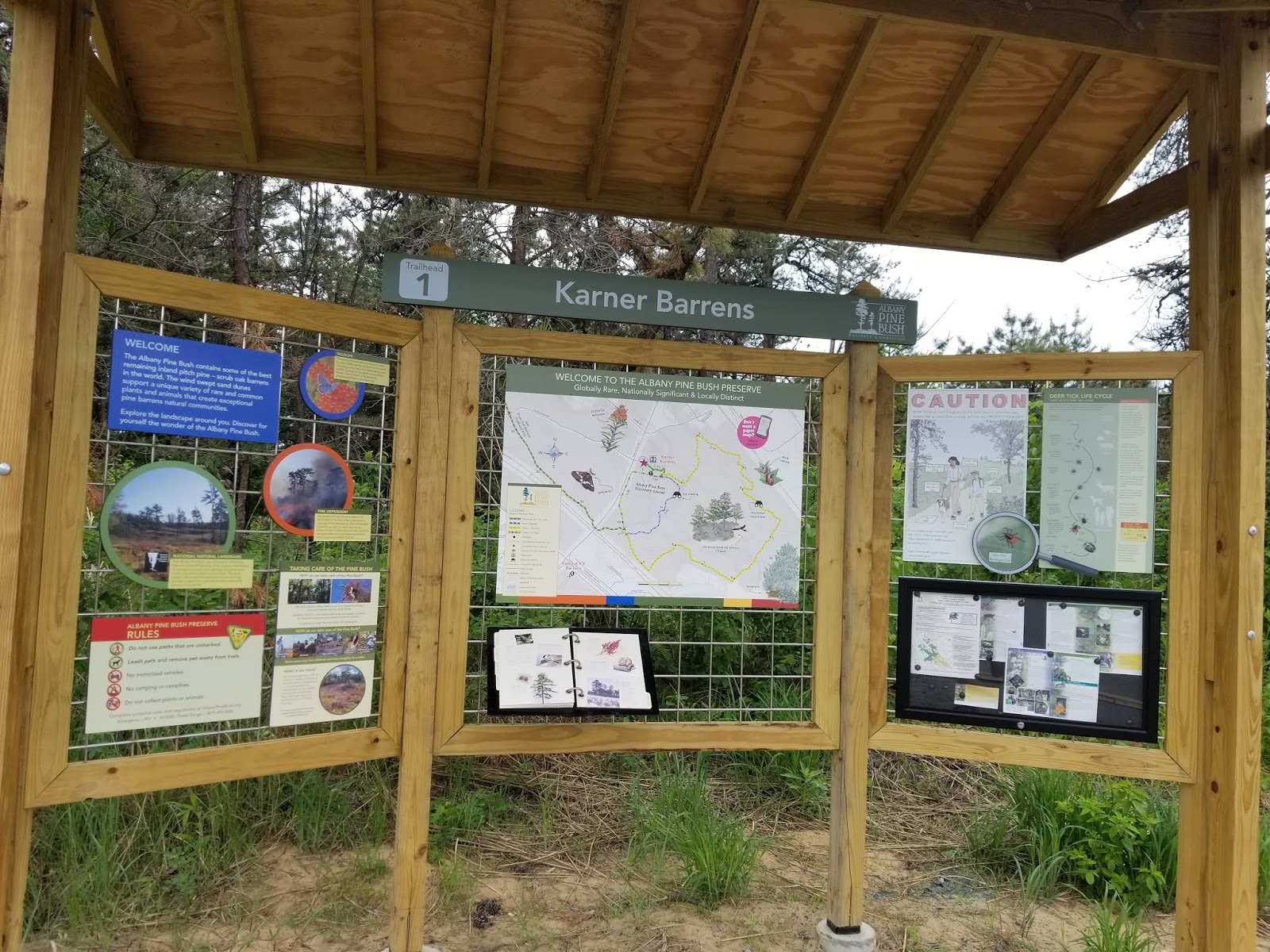
I hadn't been to the Pine Bush since last July and I noticed a few changes right at the trailhead. Trailhead kiosks have been redesigned, with paper trail maps and the DEC trail register removed.
 |
| Trailhead area |
 |
| Trailhead |
From here, I went east (clockwise) along the blue loop trail. The first portion of this trail is generally used as a StoryWalk. The current title is Hey, Little Ant by Phillip M. Hoose, Hannah Hoose, and Debbie Tilley.
 |
| Today's trail reading |
Trails throughout the Pine Bush are generally relatively flat, but there are some sand dunes that must be crossed. Trail markers are similar to typical DEC markers, but show the Pine Bush Preserve logo. Blazes are almost always posted on stakes.
 |
| Beginning of the Blue Trail. The Yellow Trail and green-blazed Discovery Trail also use this segment. |
Interpretive signage near the Discovery Center provides information on the Pine Bush. Most of this signage is located along the short, ADA accessible Discovery Trail.

 |
| Above the sign |
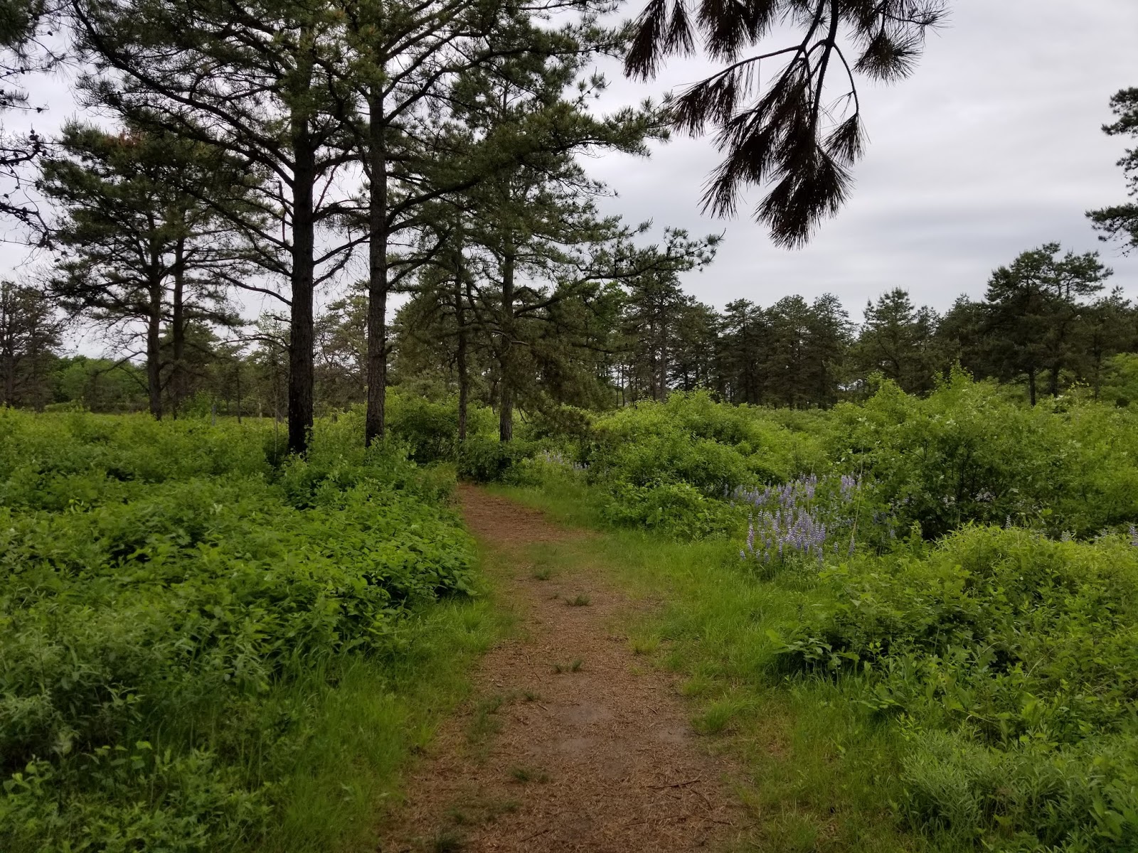
Soon, the Blue Trail sets off on its own and the trail becomes sandy. In this portion of the preserve, trails are generally well-worn and easy to follow even if there weren't blazes.
 |
| We're in pine barrens, did you expect anything other than sand? |
 |
| Remember: the ants have families, too |
One of the most striking aspects of the Pine Bush is how the flora differs from elsewhere in the Northeast.

 |
| Typical trail marker |

What goes up must go down.
 |
| Sandy steps descending a dune |
 |
| A patch of blue lupine |
 |
| A blue lupine flower |

The remainder of the standalone blue trail has some gentle ascents and descents over sand dunes, with large grassland sections containing blue lupine.

As we near the southern junction with the Yellow Trail, there is quite a bit of road noise. This parcel's southern border is the Thruway.
Reaching the southern junction, I turned right onto the combined Blue/Yellow Trail
 |
| Looking west along the combined Blue/Yellow trail |
For a very short distance, only a fence and 10 feet separates you from traffic along the Thruway.

 |
| Right along the Thruway to pass under NY Route 155 |
Immediately after the bridge, the trail bends back into the woods.
 |
| Back into the woods |
This is where my hike took a different direction than intended. See, I planned to hang a right here and proceed counterclockwise around the loop on this side. Except the loop no longer exists.
 |
| Guess I can't go that way... |
So, I continued following the new Green Trail to see where it led.
The remaining portions of the loop had also been blocked off.
 |
| Can't go that way, either |
 |
| That's the only trail to follow |
Far fewer people in this area and, as such, I had more wildlife, even if the Thruway was nearby.

 |
| Or that way... |
 |
| Guess I have to continue along the new trail |

After a while, I found myself at Old State Road. The Green Trail crosses the road here and continues along the north side of Kings Road.

Over here, I finally found what I was looking for.
 |
| Is that a... ? |
 |
| It is! |
After more than half an hour of searching, I had found a Karner blue that was willing to pose for a picture. These beautiful creatures have a wingspan of less than 2 inches.
I didn't know if I'd find another one today (I didn't), so I figured I'd grab some more pictures while this beauty was posing for me.


After a couple minutes, my pretty little Karner blue flew away, so I decided to continue on. After a short distance, I reached a newly-built trailhead and parking area. This was the new Trailhead 12.


The new trail continues over a mile to the existing Kings Road trail system. Since I didn't want to hike an extra 2-3 miles, I turned around here to begin the mile or so trek back to my car.
Retracing the green trail, I crossed Old State Road and continued back to the Blue/Yellow Trails.


Much of the Pine Bush in this area experienced prescribed fires within the past 15 months. This was quite apparent looking along the trail.
 |
| Note the charred branches |
 |
| Looking right (east) |
 |
| Looking left (northwest) |
The area around the Discovery Center had a prescribed burn in Spring 2017. I was here in April 2017, shortly after the prescribed fire.
 |
| Pine Bush in April 2017, after prescribed fire |
14 months later, the area is green again, though burn marks are visible on trees.


Back at my car, what I intended to be a short visit of under an hour had turned into an hour and a half. That's the thing about the Pine Bush. You can spend half an hour here or an entire day. No matter which you choose, it's a great experience that is always changing.
Getting Here
The Albany Pine Bush Preserve has several disjointed sections throughout the western portion of Albany, southern Colonie, and northern Guilderland. The most popular trailhead by far is Trailhead #1 at the Discovery Center, which is where I started for this hike.
Resources
Albany Pine Bush Preserve: Official website. Strongly recommend checking trail conditions and for closures before a visit, as trailheads are sometimes closed for burns or removal of invasive species.