|
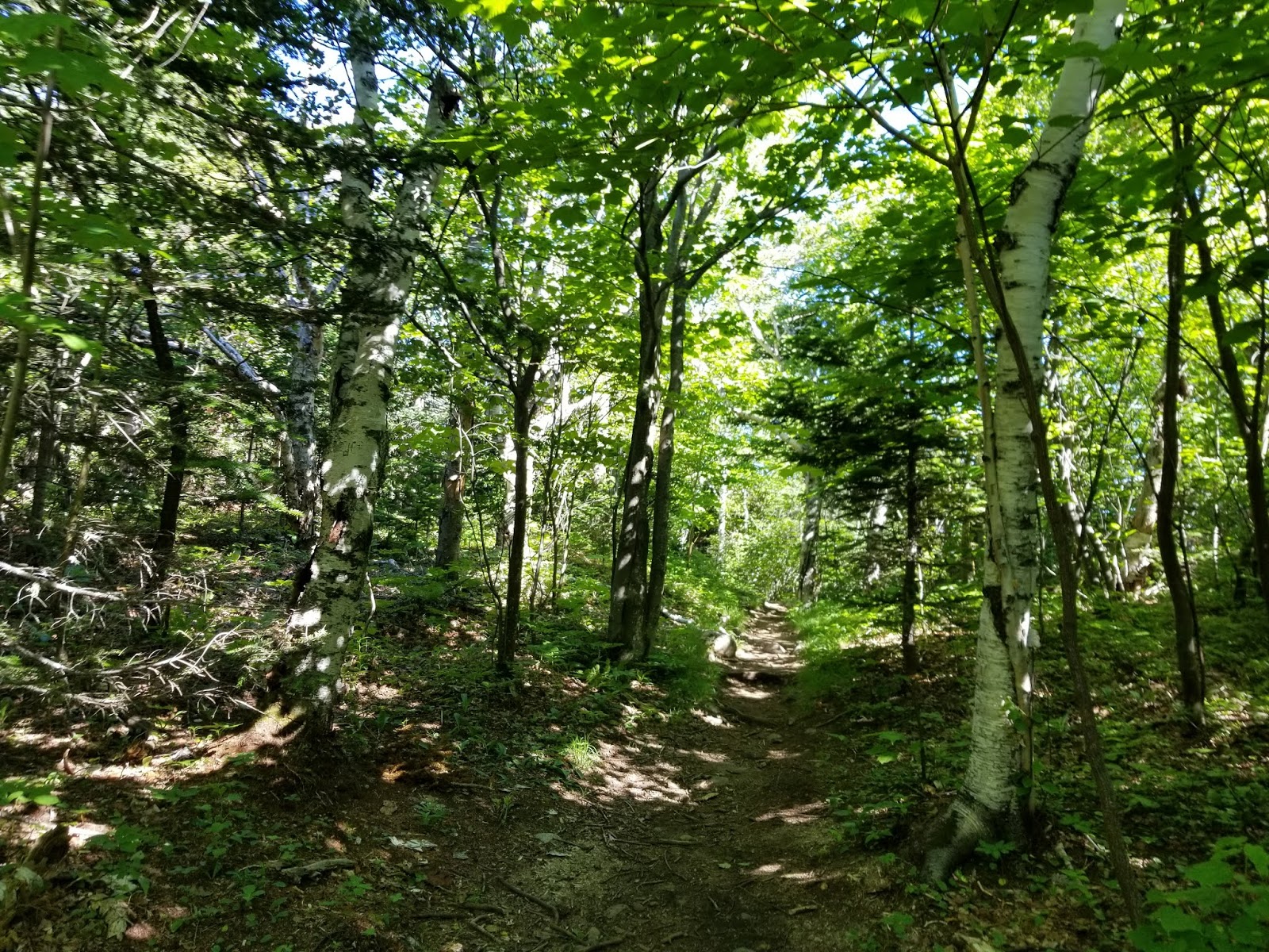
Looking toward Whiteface summit from trail
(All images mine) |
There are a million and a half blog posts, write-ups, and guides for each of the Adirondack High Peaks, especially for a popular one like Whiteface Mountain. While I wasn't originally planning to do posts for my 46er hikes, I changed my mind as I figured I could offer something beyond what the other guides have. Some of my pictures for this hike were also cut off when I was importing them from my computer, so please excuse the poor image quality for pictures after the summit of Whiteface.
Most people hiking up Whiteface detour over to Esther Mountain on the ascent or descent, as Esther is another High Peak and most of the effort required to climb Esther is long before the trails split. Note that Esther Mountain is technically a bushwhack and the trail is unmaintained, but the herd path is so well-worn that it is very easy to follow and in much better shape than several lesser-used "maintained" trails elsewhere in the Adirondacks. If done on its own, Esther is probably easier than Whiteface, as less scrambling and ascent is required to reach it.
Whiteface Mountain is notable for being one of only two places over 3,500 feet in New York that is developed. Gore Mountain is the other (barely), but it lacks water at the summit and development up there is limited to a chairlift and warming hut. While Hunter Mountain in Greene County has a ski area on the north slope, it doesn't get above 3,200 feet. There isn't water at Whiteface's summit, either, but you can get it (as well as a meal, beer, and overpriced trinkets) at "the castle", located at the toll road parking lot at an elevation of 4,610 feet. That's the other thing about Whiteface - you can drive up here if you're so inclined and (when it reopens in 2019) there's an elevator from the parking lot to the summit, so it can get quite crowded. Note that the ascent does NOT count toward the 46 if you drive on the toll road or take the elevator in either direction, as you must reach the summit by your own power.
Whiteface Mountain's other claim to fame is that it was host to the 1980 Winter Olympics. The downhill skiing events took place at the ski resort on the east slope of the mountain. The main hiking trail up the mountain crosses one of the ski trails.
The "official" trailhead for this thing is at the Wilmington Reservoir, located off of NY Route 431 just west of Wilmington. However, the most popular start point, which is where I started, is at the SUNY Atmospheric Sciences Research Center (ASRC) near Santa's Workshop, with the trail climbing up an abandoned ski lift at what was once the Marble Mountain ski area to intersect the main trail near the summit of Marble Mountain. This cuts roughly 2.5 miles and 600 feet of ascent off of the hike. It just so happens that that's a little more than the round-trip distance required to bag Esther Mountain from the main trail. Convenient, isn't it? The 0.9-mile trail from the ASRC to the main trail is unmarked, but very easy to follow. A third option for hiking Whiteface is a longer hike from the south, but it is not possible to climb Esther via this route.
I got to the trailhead around 8:30 on a Friday morning, the day after DEC lifted the mud advisory for the High Peaks. There is no parking lot for the trailhead, but plenty of parking is available along the ASRC access road.
 |
| Trail departs to the right |
A sign attached to a bench points the way, and off we go. This trailhead, not being an official DEC trailhead, does not have a trail register.
 |
| Beginning of the trail |
Initially, the trail descends slightly to a former access road. Turn slight left on the road, as directed by an arrow hung on a tree, and follow the road to the base of the first major incline.
 |
| Looking the correct way from where the access trail reaches the old road |
A green mechanical shed is located to the right at the bottom of the first hill. This likely was related to the ski lift that formerly climbed Marble Mountain.
 |
| Old mechanical shed |
 |
| Looking past shed |
At this point, side trails split off to the left and right. The left trail is a snowmobile trail leading back to Wilmington, while the right trail is roped off and posted. Keep going straight.
 |
| Straight ahead is what you want |
At this point, the ascent begins. This first major ascent is almost perfectly straight and it was once the aforementioned ski lift.
 |
| Here we go... |
In the next 2/3 mile or so, we climb 800 feet along the old tow lift. It's a pretty consistent incline and it generally all looks the same. I'll let the pictures do the talking.
 |
| Lift foundation. Note the steep slope. |
 |
| The entire section along the former lift looks like this... |
 |
| Or this |
 |
| Another set of old foundations |
Partway up the incline, there is a small shed off to the right side of the trail. This was likely used to store toboggans.
 |
| Small shed along trail |
 |
| It keeps going... |
Roughly 0.8 mile from the trailhead and 800 feet further in the air, we're at the summit of Marble Mountain, which has a small clearing. An overlook to the left provides your first real views, while the trail curves to the right and ducks back into the woods.
 |
| Trail near summit of Marble Mountain |
After a short decline, we're at the main trail.
 |
| Approaching trail junction |
While Whiteface Mountain is not signed as a destination on these signs, you want to turn
right to continue uphill.
 |
| Junction signs |
At this point, the trail starts to look more like a typical Adirondack trail. In theory, this trail is blazed with
red markers, but they are so infrequent that it is effectively an unmarked trail. That being said, it IS an official trail and it is maintained.
The trail is briefly level before beginning to climb again.
Gets pretty rocky at this point, roughly 1 mile from the trailhead.
 |
| One of the infrequent and badly-faded trail markers |
Eventually, it gets to the point where you could start calling it a scramble.
Then, we get our first large rock slabs of the day. Plenty more of these to come.
As you continue ascending, the foliage changes to evergreens.
A few sections of trail up here have a lot of exposed roots, reminiscent of hiking in the White Mountains.
The trail has, in many locations, eroded down to bare rock due to the thinness of the soil.
A little below 3,500 feet, I encountered my first real water and mud of the hike. NOW it's starting to really feel like the Adirondacks.
There was also some blowdown on the trail up here.
 |
| Only the second trail marker I spotted |
Around this point, roughly 1.5 miles from the trailhead, the bare rock started becoming wet as well.
 |
| That's going to be fun coming down... |
Continuing to ascend, the trail becomes more rugged and more wet.
Whiteface Mountain and the surrounding area is one of the few locations in the Adirondacks showing substantial lasting evidence of glaciation. This becomes very apparent as we continue to ascend, nearing 2 miles from the trailhead. The Adirondacks were greatly affected by glaciers, but this was generally to round off the mountains. Whiteface, on the other hand, got its distinctive shape from the glaciers and large number of boulders were strewn about the landscape, making Whiteface similar to the White Mountains and Alps.
 |
| Boulders left by glaciers |
I'm a bit of a sucker for rock formations and unique environments, so I'm just going to let the pictures do the talking. Hiking Whiteface, you'll see some things that are quite atypical for the Adirondacks.
The mud becomes more frequent as the trail gains altitude. A few places have logs or planks that allow you to cross the mud without stepping in it.
Another toboggan shed is immediately to the left of the trail around 2.5 miles from the trailhead.
As we approach 4,000 feet for the first time, there is an area of noticeably shorter trees
If you look to the left here, you can see Whiteface towering above the landscape. The cirques (the white areas) are what give the mountain its name.
At roughly 2.6 miles from the trailhead, we reach the herd path to Esther Mountain, marked by a sign and cairn. At this point, we're almost 4,000 feet above sea level and near the summit of Lookout Mountain, which the herd path to Esther passes over. We'll come back for Esther later...
 |
| Esther Mountain junction |
 |
| Esther Mountain is to the right |
After the Esther junction, the trail descends a bit into the col separating Lookout and Whiteface Mountains. Lots of mud and wetness up here.
 |
| Old sign for the Wilmington Trail |
Some more cool rock formations can be found along the trail.
About 3 miles into the hike, we cross an old ski trail leading down the mountain.
Continue straight across the ski trail to keep climbing.
0.1 mile later, we reach the top of a ski lift, off the trail to the left. Again, continue straight.
 |
| Ski lift to the left of trail |
 |
| Continue straight to keep climbing |
Some more cool rock formations here, as the trail goes uphill along an old ski tow line. A couple sections of this are badly eroded and require walking along ledges.
 |
| Old shovel leaning against a rock ledge |
Much more exposed rock here, as we continue to climb.
 |
| Post for old tow line |
3.4 miles from the trailhead, we reach a large stone retaining wall holding up the Whiteface Memorial Highway to the summit. Atop this wall is the upper hairpin turn. The trail takes a sharp left turn here to continue climbing alongside the wall.
 |
| Looooong way up |
If you look out to the left here, there are some views through the thin trees.
Now back to the trail. It's a steep scramble up a series of boulders.
 |
| Scramble along the wall |
 |
| Looking down the wall scramble. Lake Champlain is in the background. |
Up here, we start to get expansive views to the east and southeast.
 |
| Looking east |
 |
| Looking southeast |
 |
| Almost at the road... |
At the road. You
could walk up the road from here and take the stairs from the parking lot, but I'd strongly recommend the exposed hike up the ridge to the summit, at least ascending. The 0.4 miles along the ridge, while steep with many scrambles, has some of the best views of any section of trail in the Adirondacks.
 |
| Looking back at hairpin |
There's immediately a large scramble next to the road, and before long, we're well above the road.
Climbing a little more...
 |
| The parking lot is a short distance out of view |
The road leaves our view as we continue to climb through the thin alpine foliage along a rocky trail.
 |
| Looking east |
 |
| The trail looks like this up here |
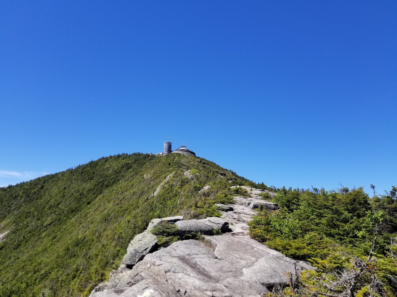
Roughly 3.6 miles from the trailhead, we hit tree line. The remaining 1/4 mile to the summit is exposed, with the trail marked by cairns and yellow paint blazes.
|
| There's the summit observatory |
With no trees to block our way, we get some great views to the south and southeast
As you continue to climb, it just gets better.
 |
| I can almost touch it... |
We're above the parking lot at this point
 |
| Parking lot and cafe/gift shop |
 |
| Looking northeast. Esther Mountain is at center. |
Enough talking, let's get to the summit.
 |
| Lake Champlain |
 |
| Closer... |
 |
| Trail markings up here are blazes and arrows |
 |
| There we go! |
The trail climbs along the left side of the summit building, passing a small shack behind the building.
 |
| So close... |
Turn to the right once you reach the trail sign and the summit, marked by a sign.
 |
| There we go! |
The last time I was up here (driving), it was quite cloudy and visibility was minimal. Not today. A 360 degree view is available when it is clear, with several of the Olympic facilities visible in the distance. Now that I had finally hiked Whiteface, I could claim it as #5.
 |
| Looking south along the summit ridge from summit marker. Most of the high peaks are in this image or behind other peaks. |
 |
| Looking southwest at Lake Placid (the lake) |
The crowds up here tend to congregate near the sign, so I hiked south along the summit ridge to get to a place where I could eat my lunch while enjoying the view.
 |
| Looking east at summit |
 |
| Looking toward Lake Champlain and the Green Mountains. Camel's Hump and Mount Mansfield are visible. |
 |
| Looking south toward most of the other High Peaks, including the Great Range (left), Marcy (center), and Algonguin (center right) |
As a science nerd, I had to get a selfie with the famous weather observatory in the background.
 |
| Your webmaster |
Lunch consumed, I was ready to start heading down. I hiked back to the observatory to look around.
 |
| The weather observatory |
From there, I started heading down. The "castle" at the parking lot has flush toilets, a cafe, and a gift shop, so that was my next stop. The descent to there is along a steep rock staircase with handrails. As the elevator is closed until 2019, this staircase and scrambles up the ridges are currently the only ways to reach the summit.
 |
| Looking down staircase toward Castle and parking lot |
The Castle (not pictured) is the only place in New York where you can buy a meal or a beer near the summit of a large mountain. While I was up here, I decided to take a break (and celebrate #5) by supporting a local brewery from 4,610 feet.
Beverage consumed, I was ready to move on to Esther. To avoid unnecessary elevation gain, I just hiked along the road until the trail runs alongside at the hairpin.
Driving up the road, there are several signs showing the elevation. The Whiteface Memorial Highway is a great drive, as well as the highest paved road in New York by roughly 1,950 feet
 |
| Looking east down the road, above the upper hairpin |
Back at the hairpin, I moved over to the trail and continued descending.
 |
| One last view of the mountains to the east |
Going down, I was able to get pictures of some of the rock formations and unique plants.
 |
| Rock formations along the trail |
 |
| Yes, the trail crosses that thing |
 |
| Uprooted trees |
Below the ski lift, it's a simple muddy descent and ascent to the Esther Junction, marked by a cairn.
 |
| Esther cairn |
If you only wanted to hike Whiteface today, you can just continue straight at the cairn. But if you would ever like to be a 46er, I'd strongly recommend doing the 2-mile "bushwhack" to Esther while you're up here.
"Bushwhack" is probably a misnomer for the herd path, as it is really a minimum-maintenance, unmarked trail that is quite easy to follow. If you haven't done much bushwhacking, this is probably a good first "bushwhack 46er". The trail generally looks the same and mud was everywhere.
 |
| The herd path is a mile (each way) of this |
First, the path climbs a short distance to the summit of Lookout Mountain, which it crosses, then descending slightly to the Lookout-Esther col.
The col has a high-elevation bog with several planks to cross the mud. Hardly the definition of "unmaintained", but I'm not complaining.
In a few places, there are views back toward the Great Range. There are also a few places with trees fallen across the trail, but they are easy to cross.
About a mile from the main trail, the summit is market by plaque on the ground. #6 for me.
The only view from Esther is back toward Whiteface.
 |
| Whiteface Mountain from Esther Mountain |
There isn't much room to sit up here and the bugs were horrendous, so I rested a couple minutes and began the 3.6-mile trip back to the car.
 |
| Tree across the trail |
 |
| Cairn at the main trail |
Back at the main trail, it was pretty much all downhill from here. But "downhill" doesn't mean "easy". The 1.7 miles of trail between the Esther junction and the ASRC junction is probably harder downhill due to the scrambles which, during my hike, were wet and slick.
 |
| The occasional view still peeks through the trees |
 |
| Exposed slab of rock |
After what felt like an eternity, I was back at the ASRC trail junction. Make sure you turn LEFT here if you parked at the ASRC, else you'll have to hike back uphill to reach your car.
Remember the steep old tow line? That's the main thing separating you from your car. Those old foundations make excellent benches.
 |
| At the bottom! |
Past the green mechanical shed at the bottom of the former tow line, the road we came in on turns to the left, then you need to bear off to the right at the arrow (which faces incoming hikers).
 |
| Make sure you turn left here. Straight is a snowmobile trail |
 |
| Turn slight right here to get back to the trailhead |
Finally, 10.5 miles after leaving, I was back at the trailhead. Long hike and I was quite exhausted, but two more high peaks were conquered and a great day of hiking had come to a close.
Getting Here
The trailhead for this hike is located at SUNY's Atmospheric Sciences Research Center, located at the end of Marble Mountain Rd. in Wilmington. Please use designated trailhead parking and do NOT park in the ASRC parking lot.
References
- The Adirondack Mountain Club's High Peaks Trails, the guide I used while completing this hike
- National Geographic Trails Illustrated Map 746 (Saranac/Paul Smiths), the map I used